Narzuvim
Ah yes, the home of all demons. It is a place of both unity and strife and the location of the only Demon-ruled country known as Nekuram is found. Nekuram is spanning across all of Narzurvim. It plays host to many species of animal and flora. Several are... severely more dangerous than one might ask for, according to what is told, Narzurvim probably has the most dangerous creatures and things of all the three continents.— Everam, Teller of Nimenra
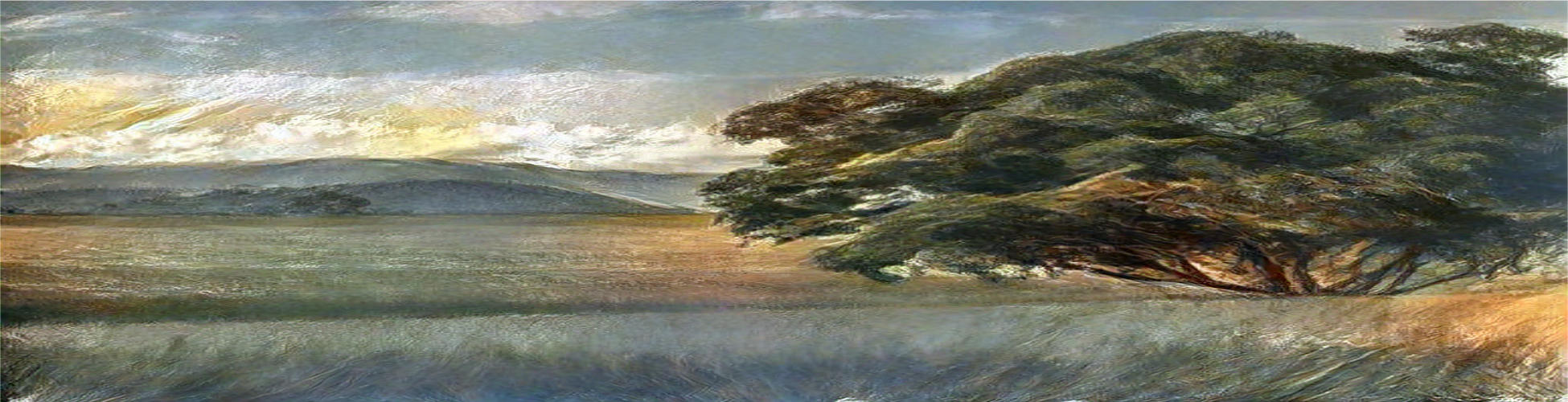
The southmost part of Nimenra, Narzuvim is where the Necur races hails from and their home country of Nekuram is located. Narzuvim is the second largest of the three subcontinents. Most of it is a temperate environment with large spanning areas of grasslands, forests, rivers and the occasional hills. There is also a vast, dense forest known as Galati Forest in the east where explorers have failed to get through and even the native Urukin don't venture through. Narzurvim is known to have the most dangerous nature of all three, mostly due to the large creatures such as Arroggaden and Giant Wolves but also due to areas such as Krakros' Firerift and Murky Shallows.
Geography
Similar to Telamirein Narzurvim have a geographical mixture from plains to riverlands to swamps and mountains. Compared to each other Narzurvim has many more extremes with the large plainlands known as the Tarus Plains with winding rivers from the mountains in the north and right next to it is the large Murky Shallows, a swampland which hosts a hostile environment unlike any in Telamirein. The west, called Central Nekuram, is the most populous and is dense with farmlands mixing with meandering rivers, spots of forests and the bordering Iar Mountains' rolling hills. The Necur capital is also located here.
Central Nekuram
The western parts of Narzurvim are home to dense populations of Necur and a temperate climate where most known flora can grow. The rolling hillsides have small mining industries while further down along the rivers and necur-made canals the farmsteads of both free peasants and tenant farmers of necur nobility farm for food and resources in the plains. Further south towards the western coastline are several smaller settlements dotted along, living on the fishing and other sea industries. The most notable natural formation is Drakken's Deirold in the centre close to the border of the Tarus Plains.
The Tarus Plains
Most know the Taurus plains to be large flat plains with some variation of hilly terrain and the large river Afonhainn. It is painted by its past of warfare and nomadic life with the Tatarus who for most of known history held to a warlike lifestyle. The remnants of this past can also be found in both built and natural formations such as The Blood Stones. At present time there are some permanent settlements, and many Tatarus live a nomadic lifestyle similar to their ancestors. At the end of Afonhainn lies an expansive river delta.
The Vampire Duchies
A sombre place with nature's beauty to be found. The Vampire Duchies lie in the dead centre of Narzurvim and mostly contain mountains and hills with rolling hills where pastures of indentured servants and labourers work the field for their masters. Two main rivers split the region and flow down into the large lake Ceannaire where several smaller communities are found. Silver is abundant thus mines are aplenty to be seen along the mountain's lower region while other hills are covered in dark oaks and spindly pines.Murky Shallows
The salendite home called Aneglnagai, or Murky Shallows, is a hostile place. The grey, dark woods and the shallow but murky waters hide many threats from both fauna and flora. While close to the clean waters of the Afonhainn River delta just due west in The Tarus Plains, the water is constantly a brown, murky kind that few can drink without succumbing to sickness that hides in it. Uisleab, the largest settlement is well known to be on the top of a hill made by Krakros to protect the Salendite from the environment. Roads are made out of clay and stone but the tide is still able to rise above a few of them in the summertime. Overall beauty is lacking according to visitors with the geographical palet of brown, grey and black. The southern end of the swamp opens up to the ocean's blue waters.
Galduria and Rhymia
At the very edge of civilisation in Narzurvim one finds the vast Galati Forest where few explorers have come back. It is situated in the regions of Galduri and Rhymia. Both share a warm temperate climate where both green plains, cool hills and a warm thick forest collide. Galduri, the hilly region of the two, lies on the western edge of the Vampire Duchies with a variation of hills, valleys and green plains. Rhymia contains a green land with fertile but yet hostile lands from several locations, the swamp lands to the west, the forest in the east and at the centre of it all, Krakros' firerift. Both regions have seen better days in terms of population due to disease outbreaks ravaging both populations, leaving most of it scarce, ruins of these events can be found everywhere. Today they are both combined into the large region of Galdurmia.
Type
Subcontinent
Alternative Names
Demon Lands (Human and Dwarven general term) Parent Location
Nimenra
Rule
Nekuram
Subcontinent
Alternative Names
Demon Lands (Human and Dwarven general term) Parent Location
Nimenra
Rule
Nekuram
Included Locations
Inhabiting Species

Comments