
Naishou Province
Naishou Province is on the northern border of the empire, forgotten between the Unicorn Clan’s Senseki Province to its west and south and the Dragon Clan’s Mucha Province to its east.
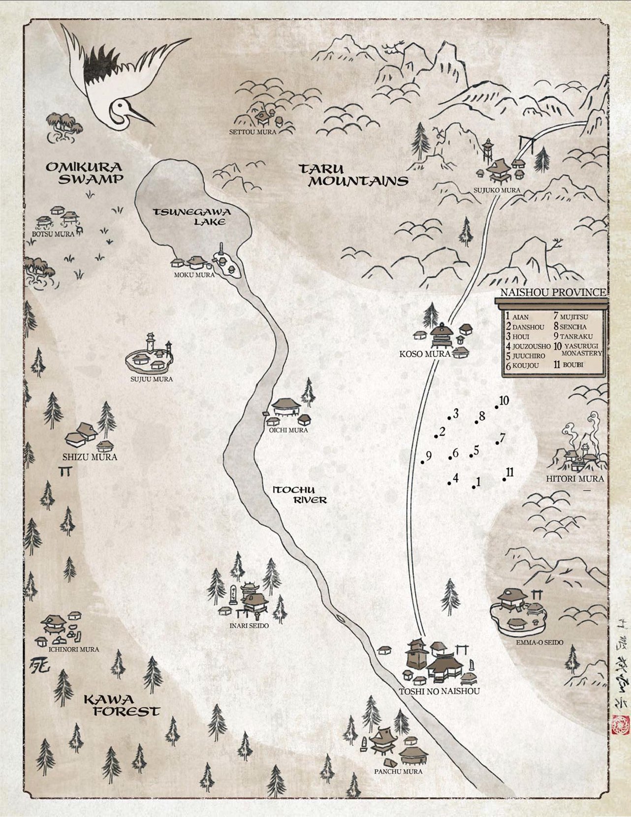
A treacherous, yet navigable, pass through the Taru Mountains connects Naishou to Mucha Province, while the Itochu River passes south out of Naishou and into Senseki province. There may be routes through the Omikura Swamp into the gaijin lands north of the empire, but if there are, they are certainly not well known or documented.
Geography
Broadly speaking, Naishou Province is a massive valley. Tsunegawa Lake and the Itochu River make the rolling plains of the central province prime farmland dotted with small to moderate groves of trees. The Taru Mountains in the north and east of the province are steep and treacherous. To the northwest is the Omikura Swamp, a seemingly endless, stinking fen and to the southwest is the Kawa Forest. Although it's much smaller than the Shinomen Forest, it could be its equal for mystery.
Maps
-
Naishou Province
A map of Naishou Province. Numerous small communities, ponds, small lakes, minor river tributaries, and quaint forests are unmarked. The map is not drawn to scale or consistency with respect to size or distance. Still, the general geographical relationships between the marked locations is accurate enough.
Type
Region
Included Locations
Legends and Rituals
SecretsStory of the dutiful daughter
Tamon and the maiden
Legend of Seido Muzaka
