Kaa Shuká (qʰaː ʃuˈkɑ́)
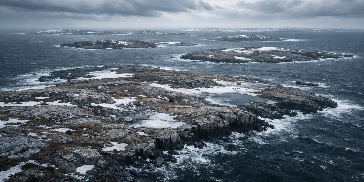
Kaa Shuká is the northernmost archipelago in the Northwestern Region and is legendarily inhospitable. Its name translates as "The Bitter Land" or "The Harsh Land" in Tleinaa'háat, and for most of recorded history the islands of Kaa Shuká were considered uninhabitable. Today, it is inhabited only by the Kimutaa, a group of selkies who followed the teachings of the Tleinataayi prophet Kaagúshaan, first seeking transformation from Human to Selkie and then migrating to Kaa Shuká so that they might be safe from a prophesied apocalypse.
The islands of Kaa Shuká are low-lying, windswept, and frigid. There is little soil, and what plants survive are small and hardy, providing little sustenance. The Kimutaa survive mostly on what they can capture from the sea, an activity for which they are well suited as selkies. Most Kimutaa communities are found along the coast and are hidden to make them difficult to spot from ships.
The Kimutaa of Kaa Shuká do not welcome visitors. Those who land on their shores can expect to be avoided at best, but it is equally likely that the Kimutaa will attack in order to drive invaders away. They have no desire to trade with outsiders, nor are they interested in making friends or allies. People who live closest to Kaa Shuká tell stories about the fates of those who push themselves upon the Kimutaa, and these are not comforting tales. In general, if left alone, the people of Kaa Shuká will return the favor, but they demand that their privacy and territory be respected.
Points of Interest
On the southernmost island of Kaa Shuká stands a lighthouse. It exists to mark the border of Kimutaa territory and to warn away any who would approach. It is part of the Ring of Light, and its keepers are among the only Kimutaa who occasionally speak with those outside the archipelago under peaceful circumstances. The lighthouse is painted red, and its beacon is known to all Sailors who travel through this part of the Great Ring. It is not a light meant to welcome one home, but it does guide ships to safety, which is away from Kaa Shuká.
Geography
Kaa Shuká is made up of over two thousand islands, spread across an area extending more than three hundred miles from east to west and one hundred and fifty miles from north to south. Most of these islands are little more than barren rocks thrust from the ocean and are incapable of sustaining even a single dwelling. Of the more substantial islands, only a handful make up the bulk of the archipelago's landmass. These are listed below.
The major islands of the Kaa Shuká (sorted by size)
This table includes all those islands in the group with an area greater than one hundred square miles.| Name | Area (sq mi) | Coordinates |
|---|---|---|
| Natchilliq | 6,119 | 74.83° North, 35.75° West |
| Kóox̱ Shukáa | 1,949 | 76.11° North, 26.08° West |
| Gunéi Káa | 1,079 | 76.58° North, 27.47° West |
| Qikiqtaq | 595 | 73.85° North, 34.7° West |
| S'igeidí Káa | 295 | 75.93° North, 30.7° West |
| K'éex' Át Káa | 212 | 74.88° North, 30.36° West |
Geographic Details
Location: Northwestern RegionLatitude: 76.16 degrees North
Longitude: 31.34 degrees West
Average Elevation: 53 ft
Highest Point: 1,010 ft
Lowest Point: -3 ft
Area: 12,341.8 sq mi
Related Articles
This article was originally written for Spooktober 2024. You can find all of my Spooktober Articles at Spooktober Central.
This article was originally written for Spooktober 2023. You can find all of my Spooktober Articles at Spooktober Central.


It's clear that you've put substantial work into this, and I admire your efforts so far. I'd love a map here (I feel it would do much more than the coordinates to help visualize these islands). I see that the lighthouse here is part of the RIng of Light, which itself implies a hefty amount of additional information. What god inhabits this place? How was the Order able to build it given the isolationism of the inhabitants?
I’ve got a mapping run planned for the world once I’ve finished defining the geography; I am still adding islands and features as I go along right now. As for the lighthouse; I’ll add a specific article for it to answer the questions!