This continent is the largest in Emnyea, consisting of deserts, mountains and grasslands. Much of the north is dominated by the
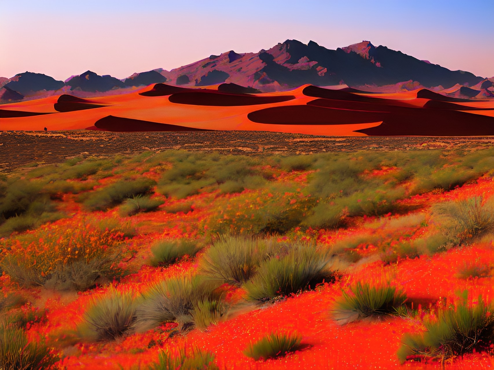
Shamsi Desert, also known as the
Radiant Dunes or
Sahra' al-Shams. This is a harsh landscape for the unprepared or unfamiliar, influenced heavily by
Rithaldis. South of Shamsi is a massive stretch of grassland, a mix between the two biomes
Kusar Wuta and
Nyasi za Rangi. These lands are heavily influenced by
Flithmar and
Kalitho, also known as the
Flickering Grasslands and
Prismatic Savannah. Nyasi za Rangi and Kusar Wuta take up the largest bulk of Alkelbulan. The southern tip of Alkelbulan,
KwaZulu, is known for its harsh storms year round and is beleived to be
Rylmer's Seat. The western coast of Alkelbulan is called
Gaarreen Ho'aa, a string of mountains and lakes also known as the
Smoldering Highlands. The landscape and peoples of Ho'aa are characterized by
Emryl magic.
Northwest Alkelbulan is often called al'Mashriq, encompassing all territories ruled by
Khalifah al-Rasul. This includes
Kna'an,
Kemet,
Birit Narim, the
Arabiyyan Desert, Dawn Ahrayn and
Balkurtiz. Kemet and Dawn Ahrayn are centers of civilization and trade, thriving fertile river valleys hugged by arid desert sands. Birit Narim, or the
Salted Badlands, are most known for their massive salt structures and gleaming rivers of light, watering the otherwise arid and craggy landscape. al-Arabiyyah waits beyond, home to a sea of sand, glass and quartz with towering dunes. At the end of this peninsula is Balkurtiz, otherwise known as
Glasspoint Ridge. North of Birit Narim is
Parsa, bridging Alkelbulan to the
Frozen Wastes and enclosing the
Keyh Sea. Finally, to the west, the lush rainforest
Musi Kongo hugs the southern end of
Skaney. The city of a bygone empire remains at the foot of numerous of waterfalls cascading from the mesa above,
Ntima-Kongo.


Comments