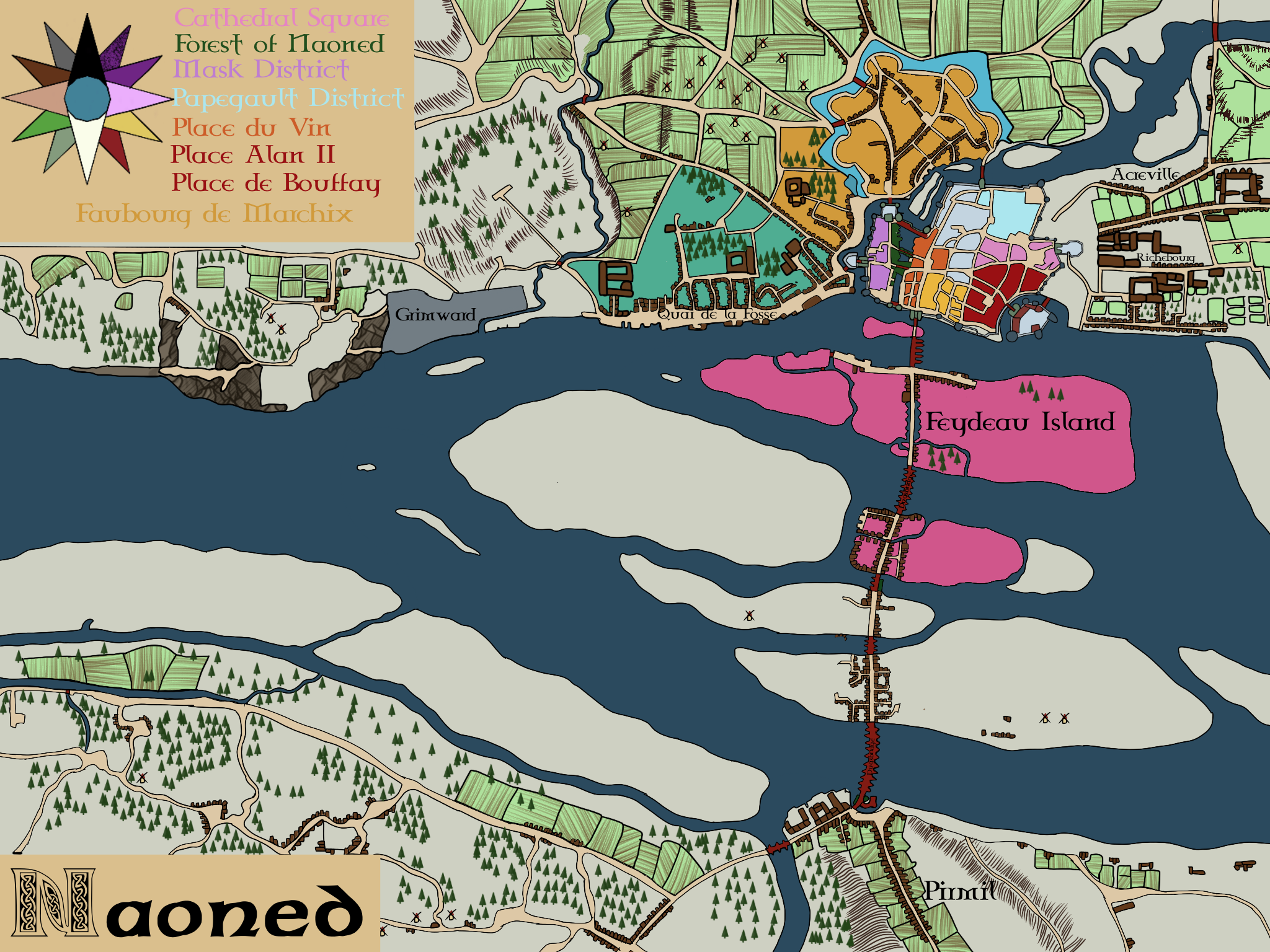
Ancreville
Demographics
Ancreville's inhabitants are a mix of Bediz, Teuz and Jetin Kriores. The large majority of the inhabitants are farmers and agricultural traders, taking advantage of the crossroads between the fields and farms of the Northeast with the city's markets and ports.
Compared to wealthier Intra-Muros Districts, Ancreville is seen as lower-middle class, but is one of the more well-off of the extra-muros regions.
Government
The Merchant Guilds hold a considerable sway over the District, with many residents belonging to one group or the other, and almost all drawing their wealth from guild-sanctioned trading.
Defences
Ancreville has no dedicated physical defenses, located outside both the city walls and external defenses, like the moat and the old palisades of Faubourg de Marchix, but benefits from these defenses, securing the point of the peninsula it sits on and preventing river access between the Erzh and the Liger River. The Erzh itself marks the Northern border of the district, providing a natural defense, and the fortified Dugsbridge across the Liger provides some protection from the West, leaving only the Eastward approach open. While the region has often been sacked by Vikings, pirates and invaders, it is better defended than other areas, such as the Hameau de Permil on the Southern Bank of the Liger.
Industry & Trade
Ancreville has little industry of its own, instead supporting largely subsistence farming and a home for the sailors, merchants and farmers who maintain the trade of agricultural produce from the fields in the East with the thriving riverports.
Infrastructure
Ancreville is largely built along two streets. Rue du Kabiten, located inland, is a straight, generally E-W aligned road leading from the moat around the city walls to the agricultural warehouses in the East. House are built along this dirt path, tightly packed on both the Northern and Southern sides. Located on the banks of the Erzh River, Rue d'Ancre bends around the "Anchor" Maen-Harz, connecting with Captain Street at this point to create a sideways "K". Rue d'Ancre is less built up than its Southern counterpart, with houses more spaced out along the Southern side, and completely missing on the Southeast. Between the rows of houses on the two streets are open pastures and sub-divided lots, used for farming by the inhabitants of the area. At the "bottom" of the "K", the district opens up to fields and Bocage
The Faubourg de Richebourg is located to the South of Ancreville, along the shores of the Liger River. There is no hard division between the two districts, but a loose boundary granting the three straight streets parallel to the quai define the Southern neighborhood.
Guilds and Factions
No established guilds are active in the District, but personal or professional loyalty to one's ship or guild is quite common in the area, exerting influence on the city's administration indirectly.
History
Originally an agricultural district, the area has seen an influx of inhabitants due to a policy under Dug Alan IV, granting small plots of land to the merchant companies that supported his ascent to the ducal throne. These have been settled by agricultural traders and retired sailors, both merchant and naval. Ancreville is generally fairly quiet compared to other areas of the city throughout its history.
Points of interest
The Kalvar, and the crossroads built next to it, marks the heart of the district, a transit point between the two streets and a common meeting place within the community. The standing stone, carved with maritime symbols, has been in place since before the establishment of Naoned as a colony of the Petty Kingdom of Gwened, at one point serving as the border of the city limits, although Ancreville itself now extends beyond it.
Architecture
The district is dominated by simple, single story houses made of stone with blue-slate roofs. a low-slung skyline befitting the quiet bedroom community.
Geography
The district is largely flat, located along the Erzh river bank, beginning to rise slightly along Rue d'Ancre after passing the Kalvar, becoming hilly at the Eastern edge of the built-up area.
Founding Date
~ 1000 SI
Founders
Alternative Name(s)
Sailor's Rest
Type
District
Location under
Owner/Ruler
Owning Organization


Comments