
Suranthi Provinces
in Suranth, The Tundra RealmsThe nation of Suranth, like their neighbors in Depenwood, are divided into six regional lands, Protectorates, Provinces, Clanholds, there are many names but they all mean the same thing. Though they all answer to King Cormac Ironcliffe, and all fall under his banner and the flag of Suranth, each of these regions have their own power struggles, diplomatic regions and even internal conflicts and strife. Sometimes skirmishes can even result, as those wealthy estate owners, barons, dukes, counts, lords and the like, along with even the appointed Protectorate families will get into conflict with each other over resources, territory or influence found in as of yet unclaimed lands within the agreed upon Suranthi borders. Such skirmishes can seem almost as if minor wars, though fought on a smaller scale than true war with thousands upon thousands on each side. Within all this however does lie a power structure, a hierarchy of sorts, through a complex set of laws and traditions, ritual rules and codes that are followed, mostly, with honor and commitment. They are a hardy, tough people too, and ultimately understand that regardless of their disagreements, here in the harshness of the tundra, when true threats emerge from the wild lands, or the Norvac Raiders land upon the coast with their long-ships and thirst for violence and plunder to please their dark masters, the Ruinous ones, the Whispering Gods of the Void. These warriors are truly the blessed of the Lords of Madness, and oft their most skilled and vicious warriors sport these gifts obviously, with horrifying 'blessings' as it were, true mutations. The most blessed raiding crews and fleets may even be accompanied by Beasts of Blackness, or even led by a Ravaging Nightmare of the Lord of Madness they honor most frequently. These raids, thankfully, are generally smaller in scale, though horrendous in nature. When threats such as these appear, the inhabitants can and will willingly put aside any disagreements they may have had, for at the end of the day, they are all Suranthi, and as such they will fight shoulder to shoulder against such evil. In truth such threats can on occasion even cause the healing of old disagreements and and feuds, as two groups whom disagree are forced to work together in a desperate struggle to survive and the heroics of it all, the heroism of the men and women who fight side by side, their acts of courage with and for each other and themselves and their families can be a bridge to mend such things.
Contained within this is a flushed out setting guide, with maps, regional descriptions, geography, plot hooks, introductions to important groups, families, individuals, and more for the Nation-State of Suranth, the Tundra Realms. A variety of settlements are covered here in detail with their own maps, so as to give one an idea, a feel for the sort of cities, towns or villages one might encounter in Suranth. So as the Storm-Lancers say...'Lluib at Vaunna!! Is at Ngem!!!!'
World Codex
Maps
-

Ironcliffe Province of Suranth
The map of the North-Eastern Realm of Suranth, the Ironcliffe Province -
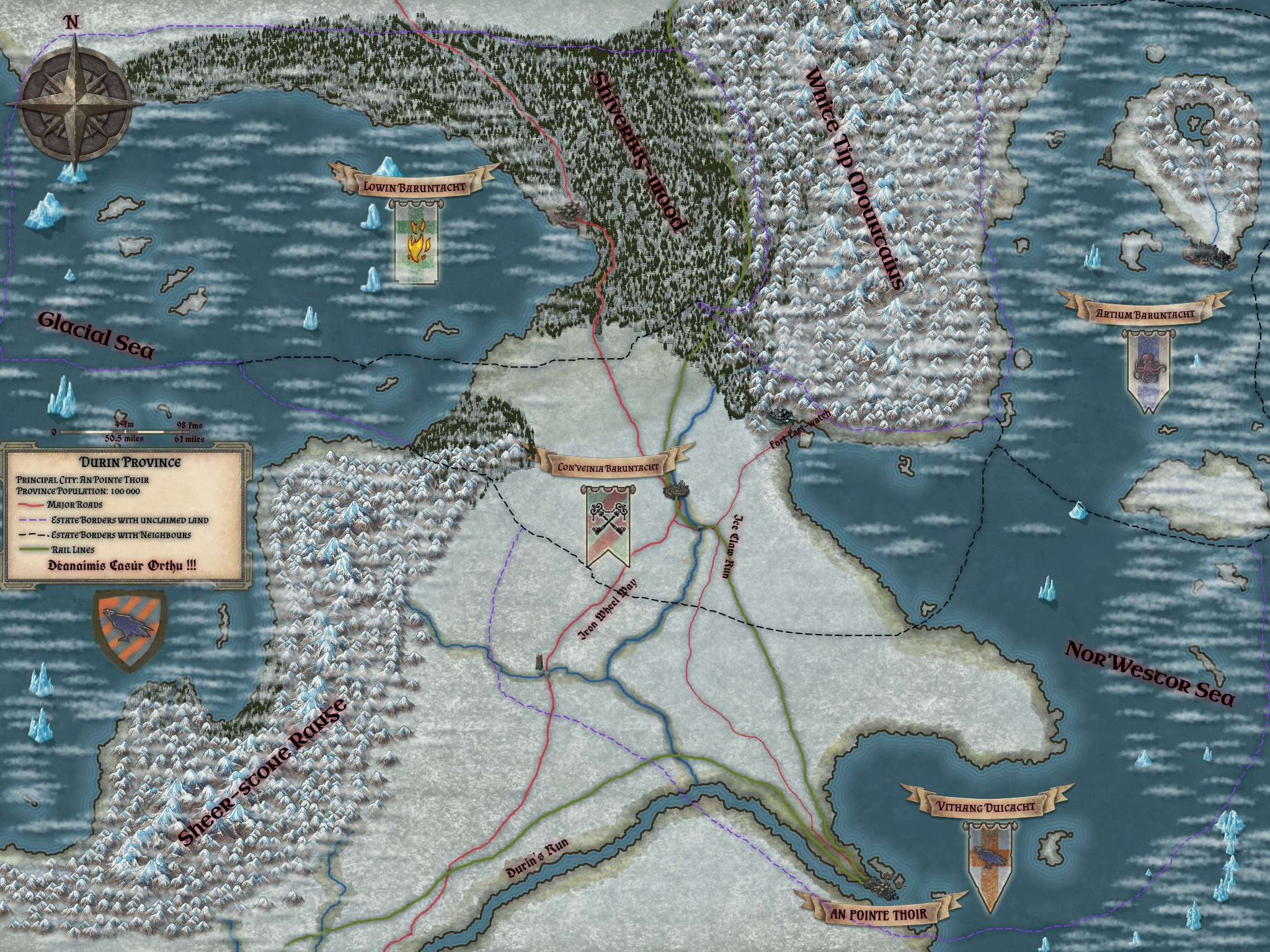
Durin Province, Suranth
Map of the Durin Province within Suranth, the lands east of the Glacial Sea. -

Stormlands Province, Suranth
The most diverse, in population, of the Tundra Realms, the Stormlands encompass everything east of the Frigvold Glaciers all the way to the west coast of Suranth, including a mountain range known aptly as the Howling Peaks. Extending south to the Budthorn Woods and to the Glacial Sea where the Tiber exits it, flowing north-west to the ocean. -
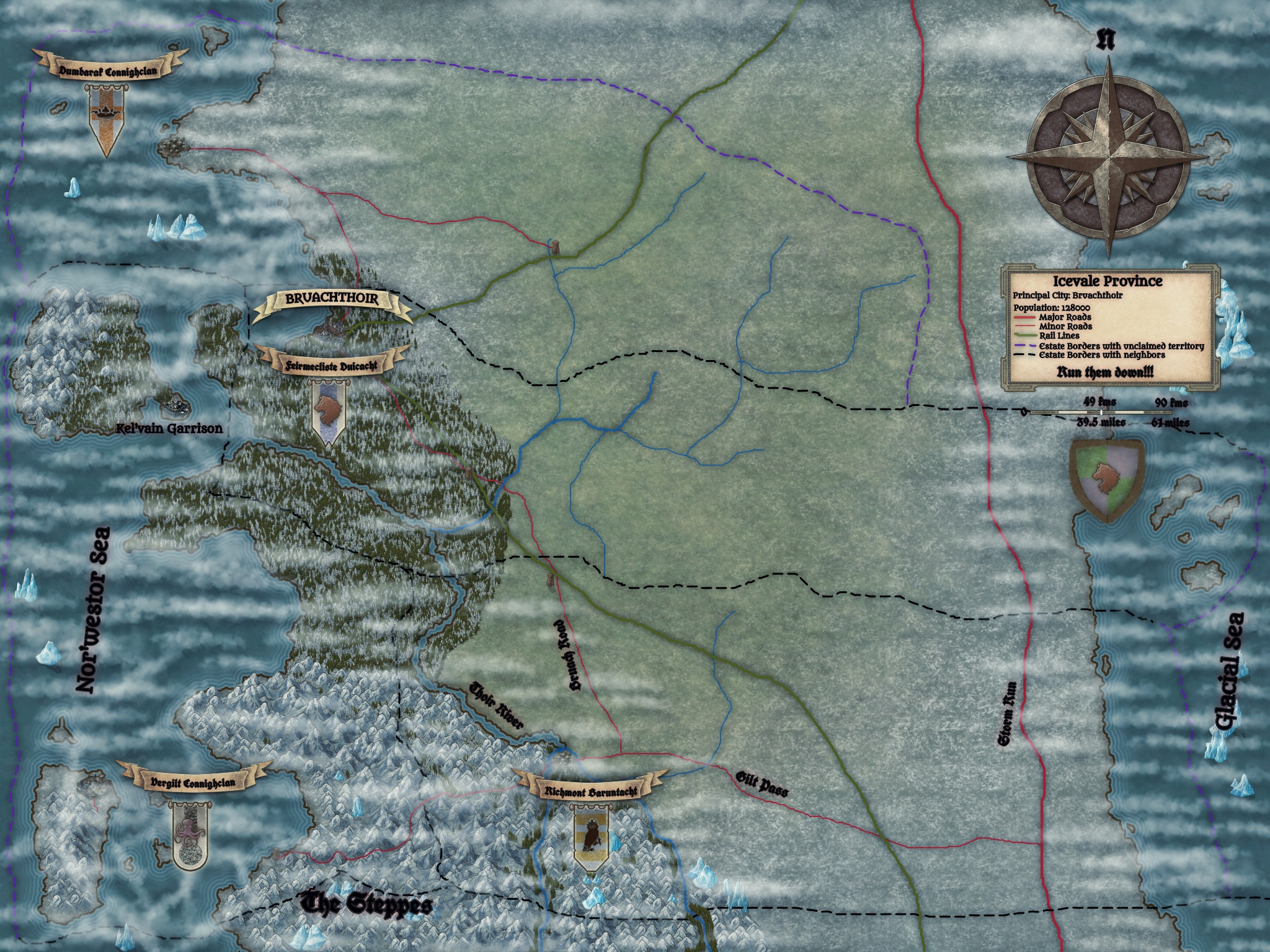
Icevale Province
The lands under the jurisdiction of Lord Protectorate Lamhghlas Marthanoirmac Feirmecliste and the Feirmecliste Clan, a sacred and ancient trust to one of the oldest, perhaps the oldest clan on Valerick, at least the dwarven clan with the oldest and most storied lineage. -
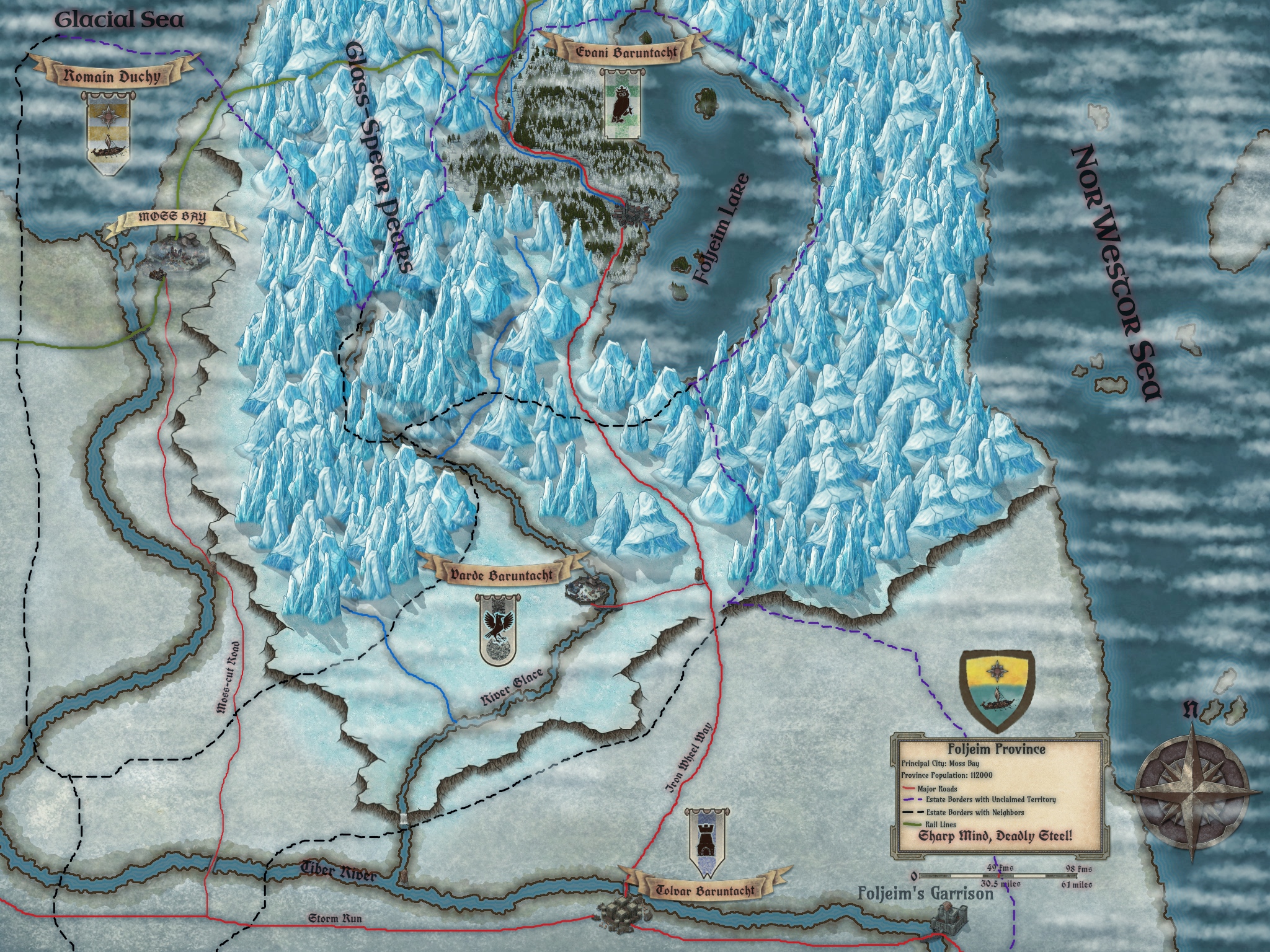
Foljeim Province
The map of the Foljeim Province, the lands southeast of the Glacial Sea. -
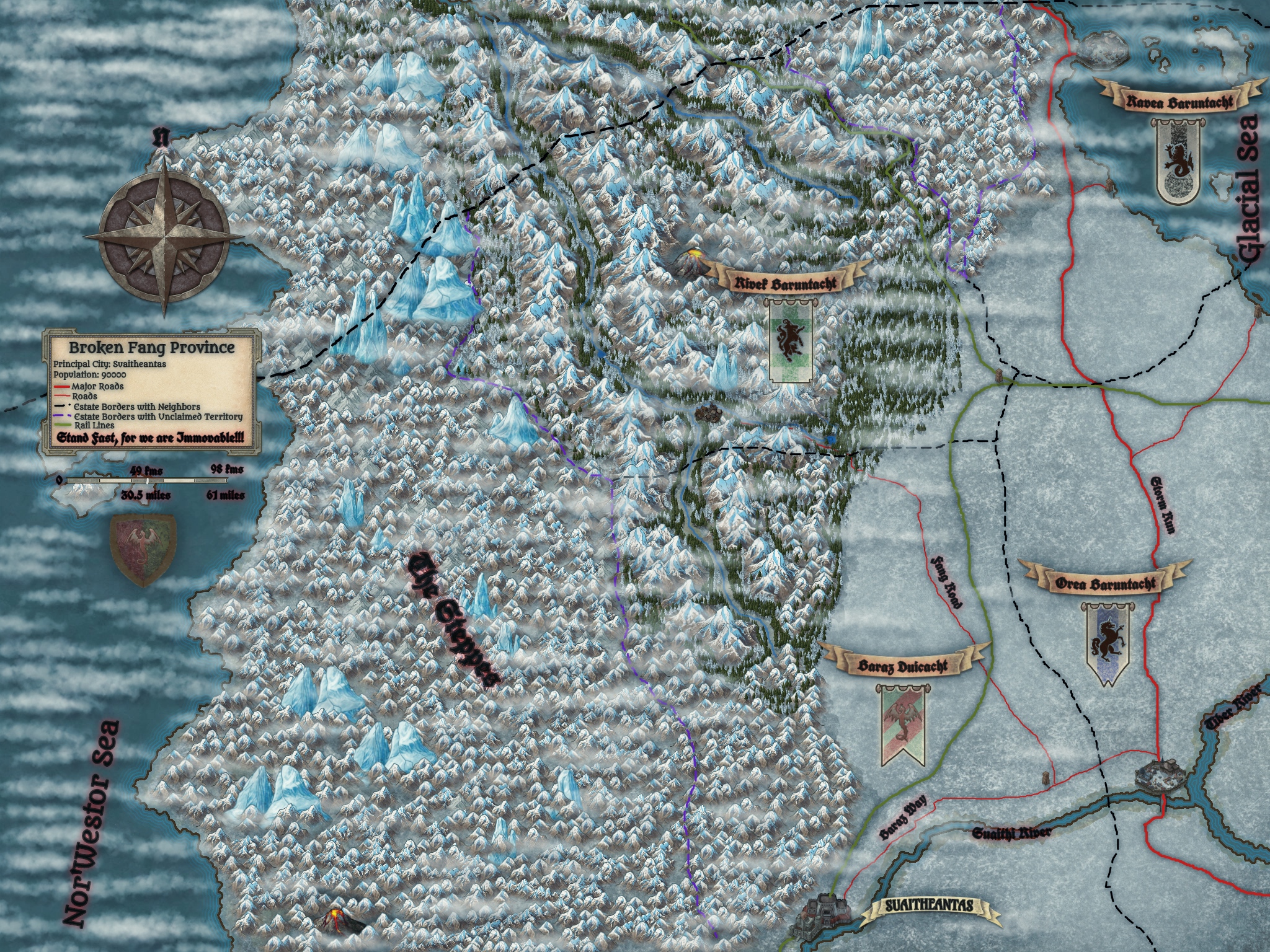
Broken Fang Province, Suranth
The smallest province of the Tundra Realms by population, this region is a harsh and tough one, seeing near constant raiding from Green-Skin, Bestial, Joten and even Dark Kin and Fell Fey alike, all from the Steppes. A hard land, with hardy and tough folk, oft known as the Bulwark of the Tundra.