Sherwood Forest
I have no more chance of persuading the public that Sherwood Forest was not a wood than Professor JC Holt has of getting people to believe that Robin Hood really lived in Barnsdale (west Yorkshire). But I must try. Dr Oliver Rackham, The History of the Countryside (JM Dent 1986)
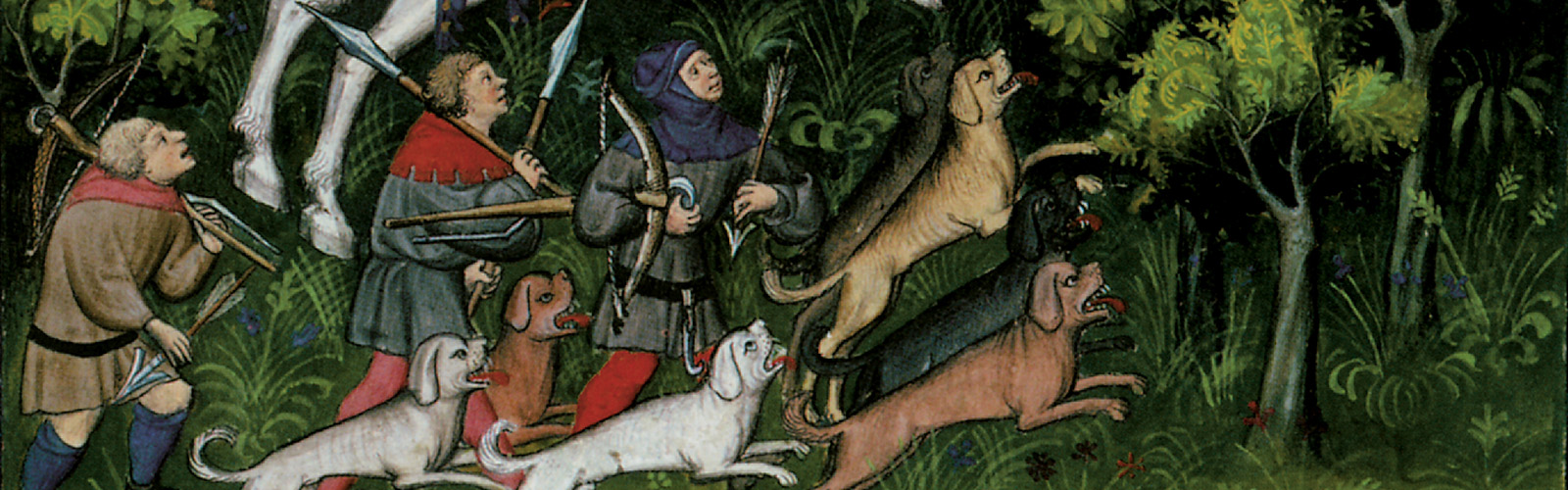
Sherwood Forest is a royal hunting preserve in Nottinghamshire between the River Trent in the south and the River Meden in the north. The area covered by Forest Law covers about 100,000 acres, running 20 miles north-south and about 8 miles east-west. The boroughs of Nottingham has excluded from Forest Law to the town limits.
It is not one continuous stretch of woodland, but a mosaic of small woods, deer parks, heathland, villages and fields. The main roads from Nottingham to York and from Nottingham to Mansfield pass through the forest. The entire area is subject to Forest Law, monitored and enforced by royal officials - foresters, verderers, agisters and regarders - who ensure the various habitats are kept suitable for deer and who guard against poachers. Offences against Forest Law are judged at the Forest Eyre, an irregular court dedicated to the purpose.
The kings of England maintain a hunting lodge (actually a complex of buildings) known as the King's Houses at Clipstone. The lodge is a favourite residence of John, Count of Mortain who often stays there when he visits Nottinghamshire. Since he was granted Nottinghamshire in late 1189, Count John has built a second lodge at Kingshaugh, in the Forest of the Clay.
The boundaries of Sherwood are occasionally monitored by irregular perambulations. Records of these survive from 1218, 1232, 1300 and 1609, showing the boundaries changed as various areas were afforested (added to the area subject to Forest Law) or disafforested (removed from the Forest Law). The perambulations of 1232 and 1300 are identical.
Sherwood is not the only forest in Nottinghamshire. In the later 12th century and the early years of the 13th century Hatfield Forest, north of Sherwood, and the Forest of the Clay, nort-east of Sherwood, were also subject to Forest Law. They were disafforested after Magna Carta, when barons insisted forests created during or after the reign of King Henry II be removed.
The hereditary wardens of all the forests in Nottinghamshire and Derbyshire from at least the early 1190s to around 1212 are Matilda de Caux and Ralph Fitzstephen, whose primary residence is at Laxton. After this, the wardensship passes to their heirs, the Birkns and the Everhinghams, until Robert de Everingham II is removed from office for grievious abuse of his position in 1286. After this the office of warden becomes in a regular royal appointment, not a hereditary one.
Structure
Assets
The King's Enclosures
A section entitled Hee sunt mete et bunde hayearum domini regis in Schirewode (Here are the metes and bounds of the lord king's enclosures within Sherwood), a description of the boundaries of the royal deer parks of Sherwood in 1323, survives in PRO Treasury of Receipt Miscellaneous Book No. 76, known as The Sherwood Forest Book. The text is in Latin; the translation is mine.
The word hayea, which I'm translating as enclosure, properly means a hedged enclosure. It derives from the Old French haie (hedge), not the Old English heg (dried grass). They were referred to as the King's Hays in Middle English, but since this use of the word is now archaic I'm going with 'enclosure' to avoid confusion with meadows. Incidentally, the village office of hayward was not there to guard the meadows; he patrolled the hedges to ensure animals didn't get into the crops,
Sufficient place names survive to identify the locations of these enclosures, if not their precise boundaries. The great enclosure of Bilhaugh-Birklands survives today as the Sherwood Forest Country Park, a national nature reserve.
Several enclosures - Clumber, Carburton, Osland, Fullwood and Kingshaw - lie outside the known 13th century boundaries of Sherwood. Some, such as Clumber, Carburton and Kingshaw, may be survivals of the forests of Hatfield and the Clay, which we know existed in the later 12th century. But my current working hypothesis is that these were royal deer parks on royal demesne lands, outside Sherwood proper but administered by forest officials. I'll do more digging and see what I can find.
Lindeby (Linby)
The enclosure of Lyndeby1 begins at the head of Rufoud (Rounsefen)2 by le Merkedale3 by adding there the wood of Newstead Priory to the new trench which separates the wood of Kirkeby4 and the lord's enclosure as far as the ford of Moselleyg5, and then by turning the wood of Annesley from the said enclosure to Fermley6 and then by dividing the wood of Annesley from the said enclosure as far as Barrehoke7 by Hesingergate8 and from the same place is divided the common wood of Lyndeby from the said enclosure by a trench as far as the enclosure of the field of Lyndeby [called Wyghowe]9; The said enclosure is divided by the water of the Lene10 from the wood of the Newstead Priory to the curtilage of the same Priory, and thus the said enclsure is divided by the water of the Lene from the wood of the said Priory to the small stream of Rounsefen, and in the same place we find that one lake of a certain mill is partly on the side of the enclosure and the other half is on the wood of the said Priory and thus the aforesaid enclosure is divided by the said little stream from the wood of the said Priory to the lake of Rounsefen, of which one half is on the side of the enclosure and the other half is on the side of the said Priory and thus from the said lake is divided the said enclosure from the wood of the said Priory as far as Merkedale, where the said boundary began.1 Linby.
2 Uncertain.
3 Uncertain.
4 Probably Kirkby Woodhouse.
5 Possibly somewhere near Mosley Farm;which is mentioned in the cartularies of Welbeck and Newstead in the 13th century.
6 Possibly the Farley Brook, north of Hucknall.
7 Possible Barracks Farm, north east of Papplewick.
8 A road name, location uncertain.
9 The words 'from Wyghowe' are inserted in the Middleton Forest Book, an English version of the document held by the University of Nottingham. 'Wighay' is marked on the Chapman map of 1774 as an enclosure east of Linby.
10 The River Leen
In short, what we can say for certain of the king's deer park of Linby is that it lies between Kirkby Woodhouse in the north, the lands of Newstead Priory in the east, Linby in the south, and Annesley in the west.
Willeygh (Willey)1
The Lord King's enclosure of Willegh begins at Moresike and thus is divided by Moresike as far as Milnebroke, and thus is divided by Milnebroke as far as Wrongbroke and thus is divided by Wrongbroke as far as Halledawehirst and thus is divided by Halledawehirst as far as Moresike where it began.1 Willey Wood and Willey Spring Wood lie between Annesley Woodhouse and Eastwood, just south of Felley Priory. The names of the brooks and ditches are unclear.
Clipston (Clipstone)1
The enclosure of Clipstone begins at the lake of Clipstone and thus extending to Josce's Cross and from Josce's Cross to Holmedal to the bank of Mome2 and the bank of Mome thus extending to le Weldale and thus from la Welledal extending to le Hartpitte and le Hartpitte extending to le Brademarre3 and from Brademarre to the deer leap next to the chapel of St. Edwin4, and thus extending by the way to another deer leap, then extending as far as the aforesaid lake of Clipstone.
1 The enclosure lies north of Clipstone village, on the far side of the River Maun next to the great enclosure of Billhaigh-Birkland. The English kings maintained an extensive hunting lodge known as the King's Houses or King John's Palace, at Clipstone village.
2 The River Maun
3 Bradmer Hill
4 A tall iron cross on the south edge of Birklands marks the location of St Edwin's Chapel, where Arthur Mee, writing in 1910, described a jumble of old stones as the remains of the chapel.
Bilhagh et Birkelounde (Bilhaugh-Birklands)
The enclosure of Bilhagh and Birkelounde begins at the first deer leap and extends to the oaks of Haliwelledal and thus extending by way to the last head of Haliwelledal and then extending at Thynghowe1 and then to Grymilhowe and Grymiklhowe extending to Mussemerre2 and then to Hurlunhened and then to the head of Billehaugh to the south and thus extending by the way that comes from Peverellethorpe3 as far as Depwayt, and thus extending as far as the new mill and from the new mill by the true enclosure extending to the Darnford, and then extending as far as White Stubbe, and from White Stubbe extending as far as Prestwiche, and then extending to the head of Birkelounde.
1 Thynghowe, now named Hangar Hill, was an Anglo-Norse meeting place (thing-hill).
2 What is now Assarts Field, south-east of the Ladysmith Plantation in Budby South Forest, held Musmire Pond and Musmire Hill in maps of the 18th century.
3 Perlethorpe
Bilhaugh-Birklands remains extensively wooded and is now the site of the Sherwood Forest Country Park, which contains the Major Oak, and the Sherwood Forest Visitor Centre. There is speculation that 'Birklands' derives from the Old Norse birkr lundr, suggesting a birch wood. Lundr may also mean a sacred grove. Given the presence of Thynghowe and Grymilhowe (Grim possibly being a reference to Odin), the area seems to have had significance for the Anglo-Norse.
Beskewode (Bestwood)
The enclosure of Beskwode begins at the head of Calledal and thus is divided into the enclosure of Beskwood by the way that is called Waltongate to the high road and so by the high road to the shallow water of the Lene1 which is called Bestwoodforthe and thus it is divided by the water from Lene to Morbrooke2, and so by Morbrooke to the way to the way that stretches between Arnal and Papelwike3, and so by the way to Sicketton, and so through Sicketon in the long valley as far as the gate to Redercote, and so through the hedge between the field from Arnal and Beskwood to Colledale, where it began.
1 The River Leen
2 Possibly Moor Dyke
3 The villages of Arnold and Papplewick
Beskewood survives in greatly reduced form as Bestwood Country Park, between Arnold and Hucknall.
Bullewell (Bulwell)
The wood of Bullewell begins at Ruddedike as far as Boleswelleground and so from Boleswellground to Hokenaldicke and so through Hokenaldicke to Watenowesty and thence to Milnegate and Par le Milnegate as far as the hedge of Hinedale and so through the said hedge to Thirswell and Thirleswell to the bank of the Lene and the bank of the Lene as far as Ruddesdike, where it began.
The area of Bulwell is now modern suburban housing. The location of the enclosure is hinted at by Bulwell Forest, now a golf course.
Aschelound et Roumewood (Osland and Rumewood)
These are the boundaries between the demesne wood of the lord king's which is called Aschelound and the wood of the Abbot of Welbeck in the same wood, ascending through the old dyke to the south to the king's oak, marked toward the north, which is called Sildegate, and that part to the west is the part of the Abbot, extending as far as the aforesaid boundaries.
Osland Wood lies between the River Meden and Clumber Park. This lies outside of the boundaries of the perambulations of Sherwood in 1218 and 1232, which note the River Meden as the northern boundary of Sherwood, but within the boundaries of 1609. Rumewood is one of the three jurisdictions of Serhwood in the description of 1251. More research needed to make sense of this.
Cloumbre (Clumber)
The wood of Cloumbre is of the Soke of Mansfield and Woodhouse and begins on the south side of Southehouse and extends by the way called Kirkegate and then to Warsoppe1 as far as the cross which divides the lord's fee and the king's fee of the lord of Warsoppe and the fee of Tykyll2 and to the west is the wood of the lord the wood which Thomas de Hayton and Elys son of Hubert and Peter de Cloumbre hold of the lord king and of the Soke of Mansfield.
1 Clearly Warsop village.
2 Tickhill, just over the border in Yorkshire.
Like Osland and Carburton, the enclosure of Clumber (now Clumber Park) lies outside the early 13th century boundaries of Sherwood, but inside the early 17th century boundary. I need to find a perambulation between the two to help make sense of this.
Carberton (Carburton)
The wood of Carberton begins at Halwell on the south and extends northward to Hullehostok and so to the west as far as Lynghanehaghe1 and then to the cross which is on the rod as far as Clounstre2, and then to Spriggebergh and to the heser of Salewick to the west and then to Merleerbestube from Welbeck to the south, and then to Wilhilmere, and then to Sandedal3, and then to Cockehagh, and thence to Maleholthened to the south.
1 Possibly Lingy Wood, which belonged to the nuns of Wallingwells.
2 Possibly Clown Hill
3 Sandhole
See notes for Osland and Clumber.
Fullewode (Fulwood)
Fullwood begins at Brockegreynyngges next to the land of Roger de Holbrooke and thence to Scatefborough and thence to Bolethowe, and then to Hukewell, and then to Blackwellbroke, and thence to Brockegreinyngges where it began.
A house or hamlet named Fulwood is marked on the Chapman map of 1774 between Sutton in Ashfield, Pinxton (Derbyshire) and Blackwell (Derbyshire). This also lies outside the boundaries of Sherwood.
Kynggeshawe (Kingshaw)
The enclosure of Kingshaw begins on the north side to a ditch between Darlington1 and Kingshaw, and thus extends as far as the road between Danum and Tuckesford2, and thus to the dyke which extends as far as the conduit to Marcam3, and thus to the manor of Kingsshaw4, where it began.1 Darleton
2 Tuxford
3 East Markham
4 Kingshaugh Farm, a kilometre west of Darleton, is surrounded by extensive earthworks indicating a possible manor complex. The location of Kingshaw is very clearly described. Like several other enclosures, it lies well outside the boundaries of Sherwood.
History
The oldest record of Sherwood (as Sciryuda, the woodland belonging to the shire) was in 958 CE. Sherwood is first mentioned as a forest (hunting preserve) in 1154. Since it survived the disafforestation that followed Magna Carta, it is clear that it must have been a royal forest since at least the time of King Henry I.
King Henry II had a hunting lodge known as the King's Houses built at Clipstone, in the High Forest bailiwick. This remained a royal hunting lodge throughout the Middle Ages, much modified, and was visited by most kings - some of them frequently. King John and King Edward I held Parliaments there. It appears to have had a permanent staff.
Since it is unclear exactly when Sherwood was designated a royal forest, the names of the early weardens must be surmised. Since it was a forest in the first year of Henry II's reign, it is likely it was made a forest in King Henry I's reign, or earlier. We do know the names of the lords of Laxton, who were the hereditary weardens of Sherwood (and other forests of Nottinghamshire and Derbyshire) until 1286. 1. Geoffrey Alselin held Laxton at Domesday (1086)2. Robert de Caux (d. 1140) married Basike, daughter of Geoffrey Alselin and inherited Laxton through her. If Sherwood was a forest in King Henry I's time, he is the first of the hereditary wardens we know of.
3. Robert II de Caux (d. 1186), the son of Robert de Caux.
4. Matilda de Caux only child and heiress of Robert II de Caux, inherits Laxton and the wardenship. Her husband Ralph Fitzstephen holds them by right of his wife.
5. John de Birkin (date of death uncertain). Standard genealogies show him as the son of Matilda de Caux by a second marriage to Adam de Birkin following the death of Ralph Fitzstephen. David Crook has argued (convincingly in my view) that there were two Matilda de Cauxes. Matilda, daughter of Robert de Caux and wife of Raph Fitzstephen, dies without child. Laxton and the wardenship then pass, through her aunt Matilda de Caux and her husband Adam de Birkin, to John de Birkin.
6. Thomas de Birkin, d. 1230, son of John de Birkin.
7. Isabella de Birkin, d. 1251, married Robert II de Everingham, who inherits Laxton and the wardenship by right of his wife.
8. Adam de Everingham, d. 1280, their son.
9. Robert II de Everingham (d. 1287), his son, who loses the wardenship due to flagrant abuse of the position in 1286. He and his heirs continue to hold Laxton until the 17th centuiry, but the keepership becomes an office by appointment of the crown. The Sherwood Swainmote (Forest Eyre) of 1267 heard hundreds of cases of offences against the very (greenery) of the forest, of whom the biggest offender was the Abbot of Rufford Abbey, accused of felling 463 oak trees. He, however, was able to produce a charter of Henry II allowing the abbey to fell trees for building work, and was cleared of the offences. In on 3 July 1276 the steward of the forest (not the keeper), John de Lasceles, caught Robert Martham and Rober Afferton with bows arrows in the forest, arrested them, and took them to Blidworth where he intended to hold them overnight before transferring them to the prison in Nottingham Castle. During the night 20 men armed with swords, bows and arrows broke open the doors of the polpace they were held and released both men. During the fight Gilbert,a young servant of the steward, was injured and one of the attackers was killed. They attackers then went to the steward's house where they insulted him, and broke his doors and windows. An inquest by the verderers, rangers and other officers of the forest found two or three of the culprits had fled into Yorkshire, but 16 were identified and attached (arrested).
Disbandment
The forest survived the Great Disafforestation of 1300, though its boundaries were reduced, and into the Tudor period. The last remnants of its history as a royal hunting preserve came in 1818, when it was completely disafforested by Act of Parliament.
Sources
Birrell, Jean, Common Rights in the Medieval Forest: Disputes and Conflicts in the Thirteenth Century (Past & Present 117, 1987)Boulton, Helen E., The Sherwood Forest Book (Thoroton Society Record Series Vol 23, 1965)
Coke, Sir Edward, The Great Charter of the Forest (London, 1680)
Cox, J.C., The Royal Forests of England (Methuen, 1905)
Cox, J.C. and Whitworth, R.H., Forestry, Victoria History of the County of Nottingham Vol 1 (VCH, 1906)
Gaunt, Andy, Clipstone Park and the Kings Houses: Reconstructing and interpreting a medieval landscape through non-invasive techniques (University of Birmingham, 2011)
Gaunt, Andy, Geophysical Resistance Survey at Thynghowe, Hanger Hill, Sherwood Forest, Nottinghamshire, 2019 (Mercian Archaeological Services, 2019)
Langton, John, and Jones, Graham, Forests and Chases of Medieval England and Wales c. 1000-1500 (St John's Research Centre, 2010)
Nelson, William, Manwood's Treatise of the Forest Laws (4th edition, London, 1717)
Young, Charles R., The Royal Forests of England (University of Pennsylvania Press, 1979)

Comments