Brictælgis ('brik.tæl.gis)
"If it doesn't green, then it's dead! Nobody likes death, everything should live, grow, sprout. Therefore water, nurture and care for it. Your little plants will thank you one day and your magic will illuminate. Or leave it and you will wither , like those damned half-goblins!"Vinduk, the old - venerable druid 11th century BEC -

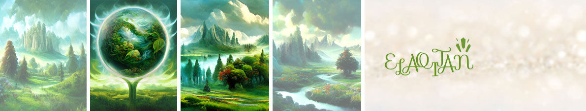
Brictælgis is the continent of the element earth "Êlgîrti" and means fertile soil. The origin of the name goes back to the capital "Prigg-Thâgi" (see Âtogôtais von Prigg-Thâgi). It covers an area of approximately 12,800 km², making it the largest continent in Elaqitan. Its inhabitants are called Brictælgica. The main race are the Adocôdix. Mainly Drælgit is spoken in various dialects.

Geography
At a glance
Total area: approx. 12.800 km²
Largest country: Âdocôris 4.595 km²
Largest inland lake: Oininhi ad Îdrucoi 1.039 km²
Largest island: Rwlè 215 km² (Taen Wôtris)
Highest mountain: Îrwu Cogoin 5.263 m (Wadrîvi)
Longest river: Swùndrûdd 1.129 km
Largest city: Tirvox ad Coimi 365 km² / 174.610 inhabitants (Âdocôris)
Average temperature: 17,8° C
Resources:: Metalle Âdaxas / Êdùxis, Holz & Batmùné, Lwgoxinâ
Important places of brictælgian magic:
Stone circles of Aslæ (Âdocôris)
Caves of Vindux (Âdocôris)
Brictælgis is located in north-central Elaqitan. The continent is surrounded in the west by the "Toiáninh ad Midri", the "Mirâni" in the south, the "Esladrùs" in the north-west, the "Oinâni" in the north-east and the "Ânigox" in the south-east.
Its appearance is primarily characterized by a hilly, green landscape lined with mixed forests. The "Îrwadri" and "Nârinhinûcoi" in the west and the "Drûddâci" in the middle east of the continent are the largest mountain ranges. In the far north are the "Tùgwlduin", a chain of huge icebergs.
The four major rivers "Swùndrûdd", "Lâris", "Thointris" and "Îrwuntra" are fed by a multitude of tributaries and streams from the great mountains. The "Îrwuntra" and the "Thointris" flow into the "Oininhi ad Îdrucoi" and the "Thoininhi", the largest inland lakes of Brictælgis.

Îrwadri (Blaue Berge) - Swùndrûdd (Fluss des Grüns) - Drûddâci (Grünlinge)

Countries
Brictaelgis comprises four lands bound together by feudal dominions. The four smaller countries are petty kingdoms or principalities that have sworn allegiance to Âdocôris as vassal states.
Name
Inhabitants
Size
Government
Capital
Inhabitants
Size
Government
Capital
Taen Wôtris
Wôtrica
3.380 km²
Petty king
Lomlâruins
Wôtrica
3.380 km²
Petty king
Lomlâruins
Wadrîvi
Wadrîvica
2.873 km²
Prince
Îdrusci
Wadrîvica
2.873 km²
Prince
Îdrusci
Râx Êvâri
Êvârica
1.952 km²
Prince
Êvâgox
Êvârica
1.952 km²
Prince
Êvâgox
Tectonics
Brictælgis lies primarily on two tectonic plates. The northern "Eslaec Plate" runs from the "Tùgwlduin" to the mountain range of the "Drûddâci" beyond the ""Swùndrûdd". This is followed by the "Brictis Plate" which extends in the south to the coast off Layida and in the To the west it borders the "Idabri Plate" on which the "Wadrîvi" peninsula lies.To the east the "Eslaec Plate" and "Brictis Plate" rub against the "Elaqis Plate".

Ecosystem
In the temperate "Wôdrûd zone" the average temperature is between 10°C and 25°C. Rain regularly moves over the hilly regions, which is why green meadows and large, extensive forests can always grow there.
In the warmer months, the climate is always slightly warm and humid at around 25°C, which promotes the growth of fungi, moss and lichen. Snowfall can occur in the colder months, but this usually only affects higher elevations or regions that lie on the edge of the polar "Ak Usdur Zone". Due to the winds of the "Mirâni", which blow mainly in a northerly direction towards Brictaelgis, the average temperature in the southern suptropical "Hépútú zone" ranges from 15°C in the colder months to about 30°C in the warmer months.
Climate Zones
On Brictælgis, the weather is mainly influenced by the colder temperate "Wôdrûd zone". Around the "Mirâni" are parts of the continent in the subtropical "Hépútú Zone" and in the north the continent is touched by the polar "Ak-Usdur Zone".
Only on the west coasts of the "Wadrîvi" peninsula in the "Hépútú zone" there are warm sea currents. Cold sea currents prevail on the remaining coasts or the northern seas of the "Wôdrûd zone".

Special natural phenomena
In the northern "Wôdrûd zone" up to the "Ak-Usdur zone" a large number of colorful auroras "Ivrâ ad Êsca" can be seen in the sky, mainly pulsating in circular waves.
Especially in Âdocôris, so-called stone and hill hikes are often spotted. It is believed that terrestrial organisms are responsible for this. However, this has not been confirmed to date.

Flora & Fauna
In the forests of the more southern "Wôdrûd zone" there are innumerable fluorescent pollens that are released by many of the plants for further dispersal during flowering. Some species of insects have specialized in this and use them either for reproduction or as food.
The warm, humid climate in the warmer months leads to the growth of huge magic mushroom meadows "Ùlvugox", which extend over larger areas. In some regions, these grow in a ring shape, so that earth magic rituals often take place here.
Many living beings can "connect" with the earth like plants, which use roots for this purpose. To do this, they use a kind of spike "Drûgæl", which absorbs earth magic during the rest phase. If this is separated, this does not necessarily mean death, but life expectancy is significantly reduced and good qualities can turn into negative ones.
Natural resources
The main resources are "Âdaxas" and "Êdùxis". The two metals are mined in the "Îrwadri" and "Drûddâci" and further processed into jewellery, tools and weapons.
The different woods of the mixed forests as well as the tendrils of the "Batmùné" are mainly used for the construction of the tree houses in which the inhabitants mainly live.
In addition, magic mushrooms "Lwgoxinâ" and herbs in all kinds of mixtures, tinctures, powders etc. are traded worldwide.


I love the amount of detail you’ve included, and I’m looking forward to seeing it expand throughout WorldEmber!
Aww thank you so much for your lovely comment.