
Droyma

by Désirée Nordlund
Winter
During winter, everything north of the Droyma mountains needs support from warmer places, like Kanohi. If the sea freezes, they are totally dependent on their storages. The southern parts still get too cold for crops, but they have more options to hunt since there is more wildlife.History
Nine lifetimes back, when it was spring, the Tangata people had most of the area west of the Mara mountains to themselves. They were nomad people moving their herds across the plain no matter the season. They had no written records, only oral stories, and the stories told they had been living this way for hundreds of lifetimes.
 The Droyma Kingdom is not as old as the Tangata people, but according to their records, their first Queen was crowned in Midhväkt nine lifetimes back. They were farmers, fishers, and timber-men, living in permanent houses.
A mountain range separated them from the Tangata people, and little did they bother each other, neither understanding the other’s culture nor wanting the other’s lands.
Aboi Jemlanger founded the Town of Fith, and he used the river to reach the Droyma Mountains and then trade with the people of the Droyma Kingdom. He came from the northeast and sought a way not to have to sail around, coming from the south. The Tangata People rarely walked further east than the river. To secure his investment, Jemlanger claimed the land from the river to the Mara Mountains in the east eight lifetimes back. It was summer.
Still summer, in the same lifetime, other people arrived, seeking land to claim for their country. They called the place where they had arrived at Rangatira. Even if they found little of interest, they stayed.
A few from the group crossed the mountains in the north into the eternal winter. They found riches in the form of clay with minerals, but when they returned, no one was interested in their findings. So they returned and founded Cha, which they claimed for their own.
When spring came again, the Tangata People found themselves blocked from both rivers. The lake at the bottom is salt and could not be given to their animals.
The Droyma Kingdom is not as old as the Tangata people, but according to their records, their first Queen was crowned in Midhväkt nine lifetimes back. They were farmers, fishers, and timber-men, living in permanent houses.
A mountain range separated them from the Tangata people, and little did they bother each other, neither understanding the other’s culture nor wanting the other’s lands.
Aboi Jemlanger founded the Town of Fith, and he used the river to reach the Droyma Mountains and then trade with the people of the Droyma Kingdom. He came from the northeast and sought a way not to have to sail around, coming from the south. The Tangata People rarely walked further east than the river. To secure his investment, Jemlanger claimed the land from the river to the Mara Mountains in the east eight lifetimes back. It was summer.
Still summer, in the same lifetime, other people arrived, seeking land to claim for their country. They called the place where they had arrived at Rangatira. Even if they found little of interest, they stayed.
A few from the group crossed the mountains in the north into the eternal winter. They found riches in the form of clay with minerals, but when they returned, no one was interested in their findings. So they returned and founded Cha, which they claimed for their own.
When spring came again, the Tangata People found themselves blocked from both rivers. The lake at the bottom is salt and could not be given to their animals.
 Before autumn, Rangatira had grown into a kingdom of their own, eliminating the Tangata People.
The Jemlanger Kingdom felt threatened by their new neighbor. They were easy prey for Rangatira, who trained for battle from an early age. Jemlanger had not needed to have anything but symbolic protection before.
Then, the Droyma Kingdom joined the battle. They wanted to protect Sial’s Well from people who did not respect the holy place. Jemlanger and Droyma had a common interest in the site, but Rangatira had a different religion and culture altogether.
Once Sial’s Well was secured, the battle continued, and by the end, Droyma was the victor.
What was left of the Rangatira Kingdom was their former capital, Kahurangi Pa, where their culture and religion remained under the rule of Droyma.
Before autumn, Rangatira had grown into a kingdom of their own, eliminating the Tangata People.
The Jemlanger Kingdom felt threatened by their new neighbor. They were easy prey for Rangatira, who trained for battle from an early age. Jemlanger had not needed to have anything but symbolic protection before.
Then, the Droyma Kingdom joined the battle. They wanted to protect Sial’s Well from people who did not respect the holy place. Jemlanger and Droyma had a common interest in the site, but Rangatira had a different religion and culture altogether.
Once Sial’s Well was secured, the battle continued, and by the end, Droyma was the victor.
What was left of the Rangatira Kingdom was their former capital, Kahurangi Pa, where their culture and religion remained under the rule of Droyma.
by Désirée Nordlund
by Désirée Nordlund
by Désirée Nordlund
Demography and Population
Droyma is dominated by bruni. There are a few with symni ancestors but they are all mixed with bruni and do not stand out in behavior. If a couple gets many children, a pair of twins, or triplets, there are plenty of jokes referring to symni ancestors.
Those who have visible traits of grön do not live on this side of the Mara Mountains. They are considered less intelligent and are targets for all kinds of humiliating jokes and harassment.
Religion
The Allvaldughers
Laws
You have to pay taxes to the leaders of your village or your town. They in turn pay to the royals. There are clerks traveling the country to check up on these things.
You are also expected to praise the Queen. Not that there are any laws that forces you, but the social code is to stay united as a nation.
You do not prefer the land on the other side of the Droyma mountains, no matter which side you live on.
Men and women have equal rights and obligations.
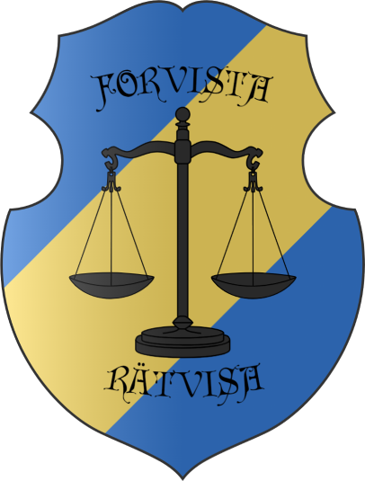
Defender of Justice
Maps
-
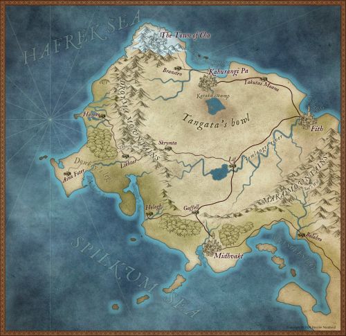
Droyma Main Map
Type
Geopolitical, Country
Capital
Government System
Monarchy, Absolute
Power Structure
Autonomous area
Economic System
Traditional
Location
Related Professions
Controlled Territories
Manufactured Items
Notable Members

Comments