Tula’tevenn Province
98,611 km square (61,274 miles)
Population Density: 31 people per square mile
Total Population: 899,494 people
Tula’tevenn Province is sparsely populated compared to the other four Provinces. A small town has roughly 200 people. Rural Population: 823,514 people (96%)
Urban Population: 8,995 people (1%)
Isolated Population: 6,985 people (3%)
Arable land: 28% (28377 km2)
Trade is very important as there isn’t a lot of farmland. The rocky soil of this province doesn’t allow for much to grow. Depending on the part of the province and the skill of the farmer, these crops can be grown: tomatoes, carrots, corn, beets, beans, potatoes, squash, mint, sage, thyme, oregano, rosemary, northern cherries, and honey apples. Produce isn’t often exported as most of what is grown is needed to feed the population. Some years they have a surplus so they’ll either store it in case of a bad year or trade with one of their neighbors. Wilderness: 70234 km2
Livestock numbers: 4338884
2950441 fowl
1388443 dairy animals
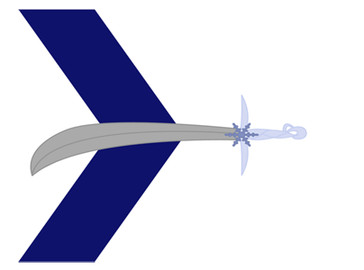
As far as weapons are concerned, they’re on par technologically speaking with Shu’venath Province, but as they have more ready access to metal they have a larger supply of things such as swords. They don’t have as many archers as the Nomads or Shu’venath Province due to the lower amount of wood in the Province. The Province is mostly populated by a mix of humans and wolflings. There are a few ryuutenshi and almost no chume’taly. People tend to stay where they are. There’s no reason to make any drastic changes. Imports: dyes, food, wood, cotton Exports: stone, metal, swords, saddles, cider,
Population Density: 31 people per square mile
Total Population: 899,494 people
Tula’tevenn Province is sparsely populated compared to the other four Provinces. A small town has roughly 200 people. Rural Population: 823,514 people (96%)
Urban Population: 8,995 people (1%)
Isolated Population: 6,985 people (3%)
Arable land: 28% (28377 km2)
Trade is very important as there isn’t a lot of farmland. The rocky soil of this province doesn’t allow for much to grow. Depending on the part of the province and the skill of the farmer, these crops can be grown: tomatoes, carrots, corn, beets, beans, potatoes, squash, mint, sage, thyme, oregano, rosemary, northern cherries, and honey apples. Produce isn’t often exported as most of what is grown is needed to feed the population. Some years they have a surplus so they’ll either store it in case of a bad year or trade with one of their neighbors. Wilderness: 70234 km2
Livestock numbers: 4338884
2950441 fowl
1388443 dairy animals
As far as weapons are concerned, they’re on par technologically speaking with Shu’venath Province, but as they have more ready access to metal they have a larger supply of things such as swords. They don’t have as many archers as the Nomads or Shu’venath Province due to the lower amount of wood in the Province. The Province is mostly populated by a mix of humans and wolflings. There are a few ryuutenshi and almost no chume’taly. People tend to stay where they are. There’s no reason to make any drastic changes. Imports: dyes, food, wood, cotton Exports: stone, metal, swords, saddles, cider,
Geography
They have dry, cool winters, mild to warm summers. The landscape is full of cliffs and caves. Most of what's left is swampy. It makes for poor farmland.
Sunrise comes early during the summer months.
This area is very accessible from the south but not as much from the north. There are barrens along the north that partially form its borders with the Nomad territories. The southern border is far more arbitrary. The Nomads to the north keep mostly to themselves save for pilgrimages to the Unnamed Ruins. To the south is Shu’venath Province, an ally of theirs.
This Province was settled initially for the deposits of stone and other mineral deposits. It was later formally established based on the preferred territory of the white dragons.
There are many small streams throughout the Province, but the most notable ones are Lake Shalainn up by Forzenn Cove and the large river that flows past Arrack-Ley. That river actually begins up in Horyinn and terminates down at Kimbala. It’s called the Uawith Channel. It’s one offshoot up in Kimbala is known as the Jualli Rill.
Fauna & Flora
The province’s apex predator is the white dragon. They ally with the other people.
Kil’varr are a kind of small brown horses with white zebra-like striping. They’re milked like goats and the milk is used to make a variety of cheeses. They can also be trained as pets.
Natural Resources
Arrack-Ley: They import marble, stone, and dyes while exporting mostly food.
Jeturas Hold: fishing, medicine making, farming, and trapping are the primary industries here. They also make oil for lamps that are fashioned in the city of Arrack-Ley.
Forzenn Cove: They make a sweet, sparkling cider that has become a traditional part of the celebration of the Day of the Lovers.
Aurann: Primary exports include perfumes, spices, ivory, and jade while they bring in iron ore and other metals.
Type
Territory
Location under
Included Locations
Included Organizations
Owner/Ruler
Owning Organization


Comments