Calgary's Tears
The twin islands of Calgary's Tears lie in the northern ocean of New Cambria, far enough away from the centres of power on Gwynedd and the capital region and the Azure Isles to escape some of the more bloody consequences of their internal wars.
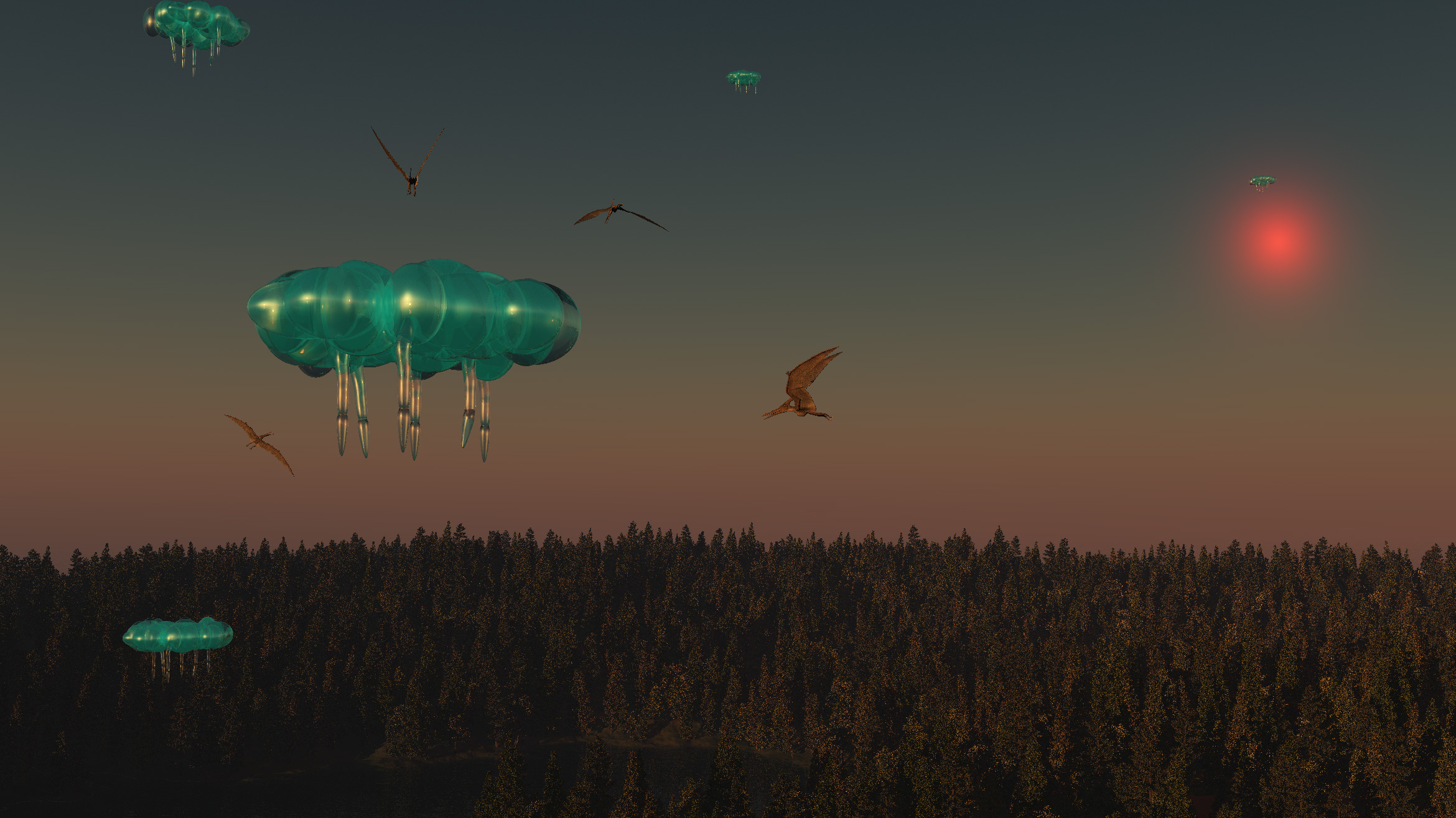
The image at the head of the page, shows the migration of sky sailors over the northern forests of the West Tear where they are often attacked by harpies.
Geography
The islands known as the West Tear and the East Tear were once part of a single land mass, broken into two by the forces of the sea and now separated by the Alberta Channel. Both islands are very roughly tear shaped and are named based on this somewhat fanciful resemblence. They are both aproximately 550 kilometeres in length from North to South along the longest axis of the tear with the East Tear being a fraction longer but a lot fatter from West to East. Taken together, their combined area is roughly comparable to something like the island of Great Britain on Earth.
The East Tear is the more populous and important of the two islands by some considerable margin. It is administered from the regional capital of Tsuu T'ina which sits in a useful central location bridging the New Bow River roughly midway between the mining lands further east, the agricultural plain known as the Grain Lands to the west and the important ports of Jake's Harbour and Southermell on the southern coast which provide access to ships from Gwynedd and the Azure Isles.
The central region of the island contains the Green Drift Hills which give rise to the Lachrimal Flow, the longest river on the island, flowing south to Jake's Harbour, the New Bow River and the Contra River, which flows to the north and east. At the far northern tip is the port of Canthus Town, where ships sail to the small polar continent of Friel (more usually known as the Cap).
The little town of Portwest offers ferry services to the even smaller town of Lynlith on the West Tear at the narrowest point of the Alberta channel. West Tear has a small fishing industry and some agricultural activity centred on the Low Brandon and Hay regions. There is also logging at Woodsea but the majority of the island is a bleak land of open moors, thick forests and cold high lakes, the largest of which is the Great Teeth Lake in the north. The Great Spine highway runs through the middle of the rugged upland, connecting Crying Point in the far north with Low Brandon in the far south. There is little human activity in the north of West Tear, aside from a few trappers and some monks. The island has been partitioned into a number of isolated estates owned by rich individuals, many of whom have shady personal histories and like the isolation afforded by the remote sites.
Maps
-

New Cambria : Calgary's Tears
The twin islands of Calgary's Tears lie in the northern seas of New Cambria
Type
Island
Location under
Comments