Idaka (i.da.'kʰa)
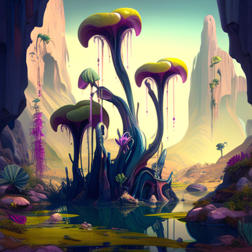
"It stank so horribly here you could have thought you'd been eating rotten eggs all day. And yet this tree was one of the most beautiful I've ever seen in my life."Syrta Khîm, naturalist - quote from her travel journal 1.625 AEC -
Idaka is the continent of humans and means being human. It covers an area of approximately 8,500 km², making it the fourth largest continent in Elaqitan. Its inhabitants are called Idacians who speak Turida.
Geography
At a glance
Total area: approx. 8.500 km²
Largest area: Akhadi 5.360 km²
Largest inland lake: Atshachi 1.066 km²
Largest island: Medri 252 km² (Akhadi)
Highest mountain: Su-Digir 4.292 m (Kana-Ameth)
Longest river: Ami-Sikil 1.595 km
Biggest city: Babe-Lu-Nin 589 km² / 681.075 inhabitants (Akhadi)
Average temperature: 21,8° C
Resources: Sulfur, Inventions
Important places:
Ruins of Amtakan (Kana-Ameth)
Sulfur-Lakes (Akhadi)
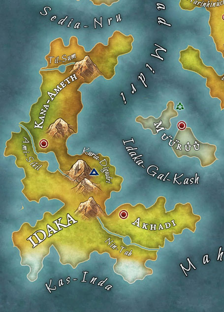
Idaka is located in western Elaqitan. The continent is surrounded in the north by the "Sedia-Nru", the "Toiáninh ad Midri" in the northeast, the "Idaka-Gal-Kash" in the east and the "Mahamhe" in the southeast, the "Kas-Inda" in the south and the "Nátúqé Lyais" and "Îbimiqùrií" to the west.
While there are hardly any deserts, wastelands or swamps and moors on the other continents of the elements, there are numerous such areas here. The "Kuria-Digudri" are Idaka's only mountain range, which stretches along the east coast from southern Idaka to the north.
The three largest rivers are the "Til-Sum", the "Ami-Sikil" and the "Nin-Tab", which feed the "Atshachi", the largest inland lake, as well as the "Shaluga" and "Tigras".
Countries
Idaka comprises two countries that could not be governed more differently. While four siblings rule like god-kings in Akhadi, politics in Kana-Ameth is democratically steered by the Council of Mether.
Name
Inhabitants
Size
Government
Capital
Inhabitants
Size
Government
Capital
Akhadi
Akhader
5.360 km²
four god-kings
Babe-Lu-Nin
Akhader
5.360 km²
four god-kings
Babe-Lu-Nin
Kana-Ameth
Kanamether
3.140 km²
Council of Mether
Euphras
Kanamether
3.140 km²
Council of Mether
Euphras
Ecosystem
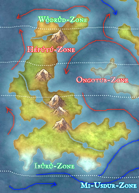
In the subtropical zones, the average temperature is 28°C to 41°C. Average temperatures in the temperate zone range from -7°C to 25°C. In the far south, cold sea currents can cause snowfall. Although there are many inhospitable regions such as deserts or swamps, these are particularly rich in species and also heavily inhabited.
Tectonics
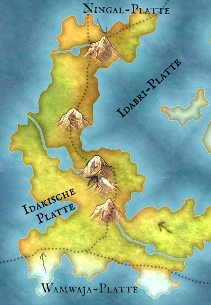
Idaka lies primarily on two tectonic plates. West Idaka lies on the "Idaki Plate". Ostidaka lies on the "Idabri Plate". In the extreme north, the "Ningal Plate" is striped by both plates. In the south, both plates meet the "Wamwaja Plate".
Climate Zones
While North Idaka is in the subtropical Hépútú Zone and Ongotub Zone and is influenced by warm ocean currents, South Idaka is in the temperate Ibûrû Zone. Only the southernmost tip of Idaka is affected by cold ocean currents.
Special natural phenomena
The warm, humid currents often create dense fog, which leads to foggy thunderstorms. In addition, there are very often hurricanes and storm surges on the coasts.
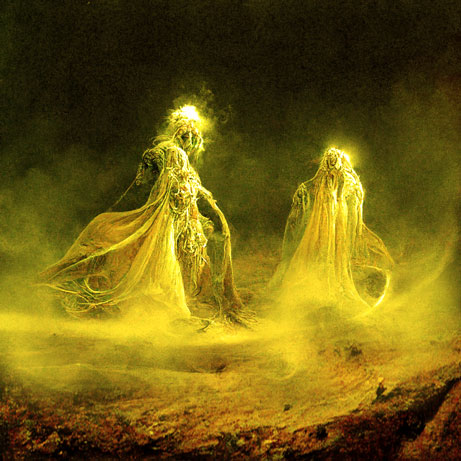
In the foggy desert, moving air circulations arise, especially at dusk, when the Idacian sulfur slowly rises in clouds. They are called Sulfur Spirits by the Idangi.
Natural resources
Idaka is rich in sulfur deposits, which are mined and used for many Idaka inventions.
Since the Idacians do not actually have access to elemental magic unless they have ascended to Homo Elaqitanii, the Idacians rely on their inventiveness. Many developments also find good markets on the continents of the elements.







Comments