Fokuhai
Fokuhai is the world's second-smallest continent, sitting mostly in the southern and western hemispheres. To the northwest lies its older and larger neighbor Tetyebyan, while the Daehan Ocean separates them from Meipyat and Gemamau. Fokuhai has the tallest average height, though not hosting the tallest mountain range.
Bioregions
Low rainfall and smooth terrain can be found throughout Eastern Fokuhai, with deciduous forests and tall grasslands rising into the central desert basin's encompassing cliffs. The eastern wall consists of the Baiyur̃ag Mountains, leading into a jagged coastline with frequent, intense storms.
Tropical North
Northern Fokuhai consists mainly of tropical forests and wetlands. The northwestern shoreline smoothly transitions from swamps to seasonal forests, with large decidous trees packed throughout the rising hills. The rocky, northeastern rainforests are much more rugged, with overgrown vegetation and coastal crags. A marshy delta is hosted on the central eastern coast, where mountain rivers and strong tides flood sediment into the Daehan Ocean.
Temperate South
The southern coasts and peninsulas sustain coniferous rainforests, more accustomed to the contrasting seasonal temperatures. Rich soil can be found near the mountains' tail end due to old volcanic activity. Rivers sweep the sediment down to the southern-most shore, causing distinctly black beaches. The eastern coastline is just as jagged as its northern half, with numerous small islands appearing when the tide is low.
Western Grasslands
The Vaihu Peninsula is almost completely prairies and savannas. The lower rolling hills are covered in tall grasses and sparse trees, while the higher moorlands host vast fields of shrubs and flowers. Towards the northeast, the rising terrain becomes littered with karst forests, becoming more ragged into the basin's northern half.
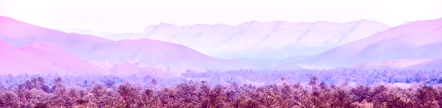
Central Desert Basin
Northern karst-speared dunes and southern badland flats make up the Central Desert Basin. The Shifting Dunes make up the northern half of the basin's Demusei Desert. Underneath lies natural Kearei deposits, with currents that topple the dunes like ocean waves. The Demusei Towers pierce through the sand, reaching into the sky with sleek, windswept figures. The southern desert is much more tattered, from both northern winds bearing down and mountainous streams cutting through.
Baiyur̃ag Mountains
Named after the mythological dragon resting around the highest summit, the Baiyur̃ag Mountains are a north-south range of snowy peaks. Bordering the southern forests, the Taiga Strip serves as a steep transition between temperate and arctic-like features.
Remove these ads. Join the Worldbuilders Guild


Comments