Mascotic Marshes
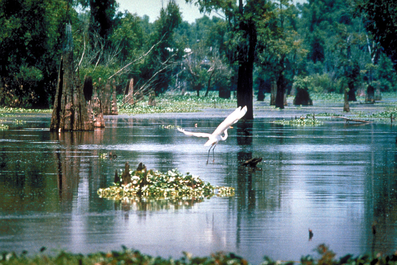
The Mascotic Marshes (/ˌmæsˈkɒt ɪk ˈmɑɹʃ əz/, Cyrontian: Τέλμα του Mίσκατους, Nemedian: Μηαχαδρα', Noamese: Hамгархаг Газар) are an expansive natural region comprised of wetland swamp, flooded grassland, submerged zypress and mangróbh forests, and alluvial floodplain, which straddles international borders in equatorial west-central Heberia. The region consists of approximately 40% wetland forest habitat and 60% marsh and open water.
The vast wetland ecosystem is located principally in southern Noam, with another large area in southern Capacyront and a smaller section at the southern tip within Nemed. Due to its ever-changing landscape and water flow patterns, permanent borders are difficult to mark, maintain or enforce. As a result the area has historically been a haven for criminals, pirates, smugglers and other unsavory characters.
The area might be best known as the home of the world’s largest coastal zypress forest, the Válto Kyparíssi (Cyrontian: Βάλτο Kυπαρίσσι), which forms the bulk of the Marshes’ northern region. As it flows south out of this lush submerged forest, the Pyrat River is flanked by a broad floodplain filled with báiou, mangróbh swamps and marshland, which eventually succumb to brackish estuarial conditions before terminating in a wide band of cordgrass marshes where the Pyrat meets Carman Bay.
No roads cross the Mascotic Marshes. Those that enter the wetland exist primarily in the north and do not penetrate the area further than 100 wmi. or so, due to the unstable nature of the land and its susceptibility to flooding. The primary, virtually exclusive, mode of transportation consists of water-borne conveyance.
Due to the area’s propensity for extended periods of inundation, the broad coastal wetland is among the most sparsely populated regions in the world, although it has supported a small but culturally distinct population of backwoods people known as Kajons since time immemorial.
The vast wetland ecosystem is located principally in southern Noam, with another large area in southern Capacyront and a smaller section at the southern tip within Nemed. Due to its ever-changing landscape and water flow patterns, permanent borders are difficult to mark, maintain or enforce. As a result the area has historically been a haven for criminals, pirates, smugglers and other unsavory characters.
Geography
Formed over millions of years by the outflow of the Pyrat River where it meets the Torrean Sea, it is by far the largest wetland area in the world, extending 1,300 wmi. from north to south and 1,200 wmi. across at its widest point, with a total area of over 840,000 sq. wmi. During the rainy season (Ricullan – Cesoren), over 90% of the Mascotic Marshes are inundated, providing habitat for the greatest diversity of water plants in the world. The immense ecosystem is also estimated to support 538 species of birds, 319 fish species, over 300 mammalian species, 195 species of amphibians and reptilians and perhaps 10,000 subspecies of invertebrates.The area might be best known as the home of the world’s largest coastal zypress forest, the Válto Kyparíssi (Cyrontian: Βάλτο Kυπαρίσσι), which forms the bulk of the Marshes’ northern region. As it flows south out of this lush submerged forest, the Pyrat River is flanked by a broad floodplain filled with báiou, mangróbh swamps and marshland, which eventually succumb to brackish estuarial conditions before terminating in a wide band of cordgrass marshes where the Pyrat meets Carman Bay.
No roads cross the Mascotic Marshes. Those that enter the wetland exist primarily in the north and do not penetrate the area further than 100 wmi. or so, due to the unstable nature of the land and its susceptibility to flooding. The primary, virtually exclusive, mode of transportation consists of water-borne conveyance.
Due to the area’s propensity for extended periods of inundation, the broad coastal wetland is among the most sparsely populated regions in the world, although it has supported a small but culturally distinct population of backwoods people known as Kajons since time immemorial.


Comments