Tamak Mountains
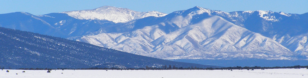
Stretching across the southern coast of Armorca are the Tamaks, mountains that divide the land between forest and tundra. With an average height of around 20,000 feet, these mountains tower over the forests that spread out from their northern slopes. In the east, they fade out near the coast to allow a narrow stretch of taiga between the foothills and the coast. In the west, they gradually form a rocky highland that eventually joins the even-higher Iceforge Mountains.
The Tamaks are considered the dividing line between habitable Armorca and uninhabitable Armorca. This is ignoring the fact that the coastal tundra south of the mountains has been inhabited by seal hunters for thousands of years, but the people who popularized that idea didn't think hunter-gatherers "counted" as a society. It is true, though, that there is no tree line on the southern flank, because no trees grow that far south anyway. The mountains themselves are largely uninhabited once you get past the foothills. Peoples of the tundra believe the mountains are the home of the gods, and revere them.
Human activity in the mountains is mostly limited to mining, and the region supplied much of the iron used in the Valaran Empire. The largest deposit of iron, however, is located on the southern side of the mountains. Several attempts to control it have been made, but prospective miners are always defeated by the problem of either running the trade routes all the way around the mountains (which is prohibitively expensive) or building a road over the mountains (which is prohibitively dangerous). To this day, the deposit remains practically untouched.
They formed over a convergent/transform boundary, and are thus prone to earthquakes and avalanches. Every year, they grow a few centimetres taller.
