Aistana:
Geography
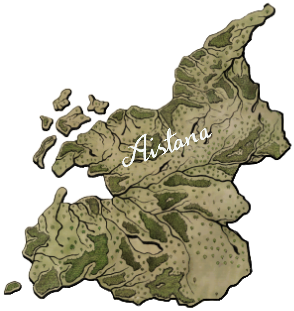
Aistana is the largest country and the most populated in Western Agia. It is part of the Flooded Scars, with the river Clûdwír running from Myndoed Galline to the south and into the western sea. Most of northern Aistana is flat, but the further south, the more mountainous and hilly it becomes.
Politics and Religion
Aistana is an elective monarchy where the Church of Irath also has its primary seat in Aistana, though it is considered an independent city state. The Holy City, Diundad da Luzven, is the name of the city state. The Church of Irath has a lot of power in Aistana and on who is going to be elected as monarch.
No other religion other than Irathism or Lasfydd is tolerated. They do like to keep the country “pure” as they say.
Bainoil:
Geography
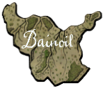
Bainoil is in the northern part of Western Agia, and therefore the climate is temperate and moist. In the middle of Bainoil there are some smaller mountains and hills, but otherwise it is a flat country. The river Rhyn runs between the border of Atlasé and Bainoil and act as an important trade route to Estain.
Politics and Religion
Bainoil is an elective monarchy, but the election is more of a formality, since the kings often have their sons elected as successor. There are no dukedoms in Bainoil, the country is divided into noble landowners who own a fiefdom given by the vassal.
Bainoil is less restrictive about religion than Aistana. The majority of the population are Irathians, but ever since the invasion from the North, Rathianic has also had a place in Bainoil. Tensions from the two opposite religions happen often, and in the meantime, a third religion has risen, the Tynelusium.
Atlasé:
Geography
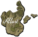
Atlasé is a flat woodland and coastal land. It is quite cold and windy place especially on the peninsula. There are two smaller islands close to the volcano on Fundras’ island, but travelling is difficult because the sea can have high waves, not to mention that the volcano on Fundras’ island is often active.
Politics and Religion
Atlasé is a hereditary monarchy, but still believes that the line of kings should be Manaes’ descendants. Almost all royals in Western Agia are distant related to each other because of the belief to keep the king’s line pure.
Atlasé was also invaded by the North and has a more religious freedom than the countries south of there. But the majority are still Irathians, despite the increase in Tynelusium and Rathianic. The biggest reason Atlasé became Irathians again was because of the purge the Church of Irath did after the invasion ended, those who did not return to the Irathian belief were killed.
Estain:
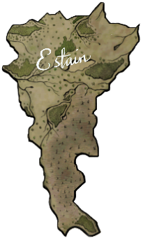
Geography
Estain is in the middle of the upper part of Western Agia. Both the rivers Clûdwír and Myklan runs through Estain from Myndoed Galline. In southern Estain, a large barren land called Lintudoma is situated. Massive lightning storms happen here often, making it near impossible to even get close to the land.
Politics and Religion
Estain is the second largest country in Western Agia, and like Aistana, was named after Manaes’ daughter when the land of Manaes was divided into two. Since the beginning of the two countries, conflicts have happened so many times. The current conflict is a cultural one, where Estain tries to get the seat of the Church of Irath moved to their newly built “holy city”.
Hevasefis is the capital of the elective monarchy. It is the noble and the bishop of Hevasefis who elects the successor from descendants of past kings.
Fundras:
Geography
Fundras is the easternmost country in Western Agia. It is not a particularly rich country with the barren and dangerous land, Lintudoma, to the south. To the north of Fundras is the active volcanic island, Vradmon, making it impossible to sail to. East of Fundras is the Chasm of the Beast where daily sacrifices keep it fed. Aside from that, it also suffers from cold and humid winters.
Politics and Religion
Fundras is an oligarchy, with a ruling college that elects one or two rulers called Drachons. The college consists of military and rich families, often connected, and it is near impossible to enter the college. Fundras is not particularly religious, and have no official religion.
Most think because it is the most unwelcoming land in Western Agia, the faith cannot be as strong. Even the Church of Irath has given up on making sure they follow Irathism and other countries are not interested in a conflict with Fundras because then they had to deal with the Beast.
Ceiragh
Geography
Ceiragh is probably the hardest place to travel to in Western Agia. Lintudoma is blocking any route from the north and most of the west. The only way to Ceiragh is through the southern coast. Even the large island south of Ceiragh is hard to travel to because cliffs and stones that are in the southern sea. Ceiragh is a warm country with an abundance of nature.
Politics and Religion
Ceiragh is a democracy. Because it is such a small country, the population is very small and therefore they come in unity in an assembly once a year. Most of the cities and towns have their own council, and only major things that affect all of Ceiragh are brought up in the assembly.
Ceiragh is vastly Irathians but has their own branch to the religious practices and traditions. They still hold funeral pyres, and everyone can afford it with the abundance of nature.
Galidynos
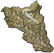
Geography
Galidynos is mostly covered by a mountain range. But has a bit of land outside the mountainous area. Galidynos has a variety of tunnels and cave systems inside the mountain range which have been used to make settlements for the Ghrefeims. Since both Clûdwír and Myklan have their origin in the mountain range, trade can be transported easily to the northern countries of Western Agia.
Politics and Religion
Galidynos is a merchant republic, with each city mostly self-governed by the city's assembly. The species Ghrefeims are the most dominant species in Galidynos. But on the border to Magaun is a small tribe of Harawyrs, that calls themselves Bucaths, residing.
Galidynos has its own religious branch of the Irathian belief, called Iragrefeimian. It basically has its own set of traditions, and stories of Irath and Ghrefeims added to their Book of Irath.
Laezla
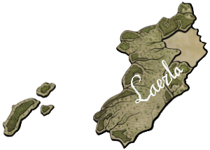
Geeography
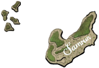
Laezla is a hot and nature rich country. It has a large lake or sea, Ezlaun, depending on culture, and has unique biodiversity. The northern and eastern part of Laezla are mountainous, while the southwest is flat. Laezla has three larger islands to its west, which is said to have a volcano erupting, but it has been millennials since it has happened. Laezla and Samrun had a dispute over the island, but has currently come to divide the islands between them. Travels to these islands do not happen often.
Politics and Religion
Laezla is formally an elective monarchy, but everyone knows the succession only happens when a king chooses his successor amongst his children. There has been an attempt to overthrow the monarchy, but with minimal success, since the nobles who own the armies have put down the rebels. It has led to the monarch is just a puppet for the nobles that threatens the monarch to do their biddings or they will end the system.
The population of Laezla are Irathians, yet they still have slight changes to the traditions.
Magaun
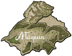
Geography
Magaun is very mountainous and hilly to its north and east. The large lake Lyni is also in the north, and the forest rich areas south of Lyni and near the coast are valuable trade to other countries for the funeral pyre. Lyni contains a unique fish named Lykópen, which is important for the tribe of Bucaths.
Politics and Religion
Magaun is a hereditary monarchy and a democracy. Just after their independence from Aistana and Estain, Aistana tried to retake Magaun through the war, but once again found it hard to maintain its grip. The monarch of Aistana at the time ordered his brother to become the new vice-king of Magaun. Since then, the monarch of Magaun has slowly developed into a figurehead to keep both the Church of Irath happy and Aistana, and it is the people of the elite who elect a leader to govern them.
Magaun’s population is vastly Irathians but enjoys a not so strict way of life that the doctrine of Irathism demands.
Reithos
Geography
Reithos is situated between Galidynos, Estain, and Magaun. It is one of the few routes from the lower part of Western Agia to the upper part outside of Galidynos that does not require a ship. Reithos is a forest rich country with a hilly landscape to the north. The climate is hot during summers and cool in winter.
Politics and Religion
Reithos is a meritocracy. In order to be accepted into the council of the king or to become king, you have to prove your knowledge of trade and philosophy. This is done through an examination to determine the best candidates, and the examinators are retired members of the council in order to avoid corruption. This still happens as the system is mostly awarding the members of the elite, the rich, or those previously in power, making it impossible for those lower in the hierarchy to even be considered.
Reithos is very faithful to the Irathian Church even if they try to do good by making a funeral pyre lottery that shadows the lottery made by the Irathian Church.
Samrun
Geography
Samrun have like most of the lower Western Agia hot summers. The three largest of the lower islands west of Samrun have gone through ownership issues with Laezla, but the compromise was to divide the six large islands between the two countries to avoid bloodshed. Samrun is a lowland and forest rich country with the risk of flooding near the larger rivers.
Politics and Religion
Samrun is an elective monarchy, the election is mostly run by the army and military service is a requirement for any males of the royal family. The more service you have provided, the higher the chance of being elected as the new monarch.
The Samrunian population is Irathians, but their culture has been influenced by the Southern Islands. The Church of Irath is not fond of this, but has accepted there is not much to do about it.
Thebas
Geography
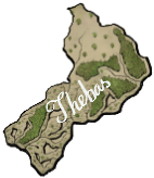
Thebas is hot during summer, yet somehow wet. A wetland area to the south which makes it difficult to build settlements there, yet is a thriving place for the biodiversity. Unlike the other countries in lower Western Agia, the forests are far less in abundance, which makes import of wood important for Thebas.
Politics and Religion
Thebas is a hereditary monarchy that stems from the monarchy of Magaun. When the vote for independence happened, the Thebasian population still wanted a king. For the sake of good relation with Magaun, they decided to have a king from the Magaunian royal family.
Despite the Magaunian royal family are figureheads, the Thebasian monarch is an active political person, and therefore Thebas has not inherited the problems which Magaun faces with its nobility.
Thebas’ population is Irathians, but have just as much, if not more, cultural heritage from the Southern Islands as some of the other lower Western Agian countries. This is mostly visible in the traditions, such as funeral pyres, much to the Church’s dismay.


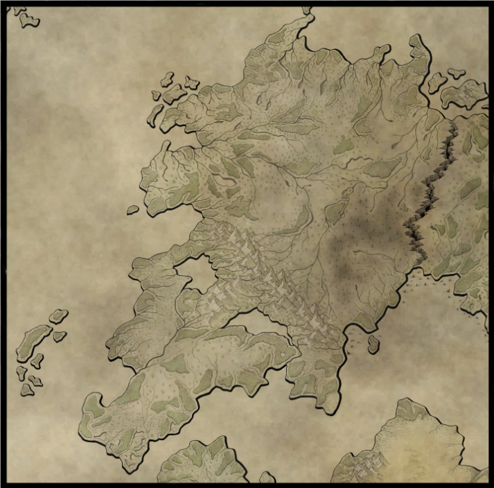




A good overview of the continent/region. My only problem is that the history part is a bit confusing in that if it talks about all of Western Agia or just one country. I love how you made the map that the reader can hover over a country and text appears on the side
If you are looking for my Worldember articles check Magic Earth or My Worldember Progress Page